
I’ve been relatively inactive the last month as a result of this year’s
warm summer. Cooking my brain in 100 degree Ojai heat just doesn’t appeal to
me. But now that summer is starting to wind down it’s time to get out again.
Frank and I wanted to go camping this weekend. We needed to pick a campsite we
knew would have water this late in the year.
So we decided that Fishbowls would probably be a good choice for an
overnighter.
It took us a couple of hours to drive north up the 33, past the Ozena Fire Station, then Lockwood Valley Road east, then back south on Mutau Flat Road towards the Grade Valley. Finally we got to the Fishbowls trailhead. The trail is a big loop that starts at Fishbowls TH and finishes at the Cedar Creek TH 2.5 miles further south down the road (See the map at the bottom of this post). Craig Carry’s book Hiking and Backpacking Santa Barbara & Ventura suggested leaving the Jeep at the Cedar Creek TH 2.5 miles further down the road then walk back to Fishbowls TH. The logic being that covering that stretch of road will be easier on fresh legs. But I’m lazy, my logic was to park at the Fishbowls trailhead, then hope that the next day someone would see us walking up the road and take pity and give us a ride back to the Jeep.
It took us a couple of hours to drive north up the 33, past the Ozena Fire Station, then Lockwood Valley Road east, then back south on Mutau Flat Road towards the Grade Valley. Finally we got to the Fishbowls trailhead. The trail is a big loop that starts at Fishbowls TH and finishes at the Cedar Creek TH 2.5 miles further south down the road (See the map at the bottom of this post). Craig Carry’s book Hiking and Backpacking Santa Barbara & Ventura suggested leaving the Jeep at the Cedar Creek TH 2.5 miles further down the road then walk back to Fishbowls TH. The logic being that covering that stretch of road will be easier on fresh legs. But I’m lazy, my logic was to park at the Fishbowls trailhead, then hope that the next day someone would see us walking up the road and take pity and give us a ride back to the Jeep.


The only other vehicle at the trailhead was a firefighting
truck (the modified pickup kind, not a huge fire engine ). The trail started
out easy. It’s well maintained. It looks like a crew went through recently and
cut most of the trees that had fallen and blocked the trail. As we made our way
the trail stayed pretty easy. I guess we were gaining elevation but it was barely
noticeable.

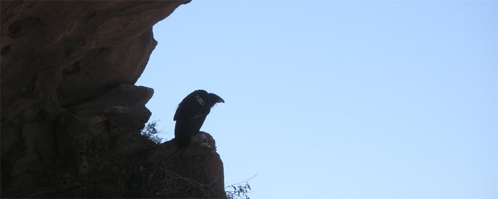
A couple of bi-planes, I had to be quick with my camera
We ran into the firefighter after about an half an hour. He said he
was just out to stretch his legs and was on his way back to his truck. After an
hour of hiking we came upon a gate. I learned in Craig's book that this marked the end of an old 4x4 road we
had been walking on. There’s also a Sespe Wilderness sign here. It’s one these
new plastic composite signs. I don't know why they don't use wood anymore.


Same classic design
There are lots of creek crossings on the trail. These were easy
for us because Piru Creek is bone dry and dusty. The huge pine and cedar trees
that populate the area seemed indifferent to the torrid conditions. About an hour
and half after the gate we came upon another sign


Fishbowls Camp
Just past the sign is the main Fishbowls camp. Nestled in
among some large boulders is a iron grill and a stone fire ring. There are a
few flat spots for tents. Behind the boulders is another iron grill and a big
flat exposed area for more tents. There’s a creek that goes by just below the
campsite. It was dry like the others we had passed. We were really hoping that
the fishbowls would have some water. We
threw down our stuff and grabbed our water gathering containers. We followed
the trail out of the camp and onto the other side of the dry creek bed. A few
yards further and another sign points the way towards Cedar Camp.

Back at the camp I set up a hammock. I read for awhile until I dozed off for a few
hours. When I woke up it was time to make diner. Frank was generous enough to
bring and share a couple of cans of Boones Ale. The day had been warm, but not uncomfortable.
After the sun went down, it got a little chilly.
Hot days don’t always equal hot nights as Frank was about to be reminded. While I was sleeping comfortably in my down sleeping bag Frank was freezing because he only brought a sheet to keep himself warm. At some point in the night it became too much and he took my hammock down and used it as a blanket.
Hot days don’t always equal hot nights as Frank was about to be reminded. While I was sleeping comfortably in my down sleeping bag Frank was freezing because he only brought a sheet to keep himself warm. At some point in the night it became too much and he took my hammock down and used it as a blanket.
The morning brought back the sun and warmth. We packed up
and headed out towards Cedar Camp. The trail climbs a few hundred feet over a
few miles then peaks out. Just past the peak we came upon a sign lying on the
ground. This marked where the trails split for Pine Mountain Lodge to the west
and Cedar Camp to the east.


Just past this junction I saw a guy coming up the trail from Cedar. “Howdy.” I said and he greeted us back. We told him where we coming from. He looked familiar to me. “Is your name Howard?” I asked. “How the hell did you know that?” he replied, perplexed. Ha, it was Howard. I've read this guy’s blog and heard some stories about his runs in the woods. The guy is an ultra-marathon runner. Not marathons, ultra-marathons. The Sespe hike we did a few years ago took us five days. Howard and his buddy did it in twelve hours. So I tell him how I recognize him and who I am so he isn’t creeped out. He told us that he had spent the night at Thorn Meadows (or Snedden Camp depending on what map your looking at). He had jogged out to Thorn Point earlier in the morning and he was now tackling the Fishbowls loop. We told him the water situation and bid him a good run. A few minutes later we hit the switchbacks that are right above Cedar Camp.


We stopped at Cedar Camp for a quick lunch break. This is a nice, large camp. There are several sites that can handle few different camping groups. The campsite is home to many enormous Cedars and Pines. There’s a creek that cuts by in dramatic fashion. We spent about twenty minutes eating and then it was back to the trail.

After Cedar the trail is all downhill. It was pretty nice. We startled some deer that were probably out looking for something to drink. We were making good time; I was hoping to get back to the Jeep before the afternoon heat kicked into full force. It wasn’t too long before we saw another Forest Service sign marking the end of the trail. This was the Cedar Creek trailhead. I took a few pictures of the signs. We were about to start walking the road back to Fishbowls TH when I saw a figure trotting down the road towards us. “You gotta be kidding me.” I said. It was Howard. He had completed the loop in the same time it had taken Frank and I to walk from Cedar to the road. I was flabbergasted. He didn’t even seem winded. He just smiled and expressed some regret about not beating us. We bid him farewell again and started up the road. There were a lot of motorcycle and quadrunners out enjoying the OHV trails. After about a mile Howard pulled up in his pickup and gave us ride back to the Jeep. I love it when a plan comes together.

Ha! Fantastic. Usually I would advise against accepting rides from strangers ... but nobody's stranger than H'ard (and you survived). ;-)
ReplyDeleteGreat write up, was there any water at Cedar Creek CG?
ReplyDeleteYes, there was little water at Cedar Creek. It was a similar situation as Fishbowls i.e. slow trickling and not to appealing, but drinkable if you filter. Thanks for reading the blog.
ReplyDelete