Sunday, August 9, 2020

Conejo Valley Chumash Rock Art Cave


I've been exploring the Thousand Oaks area a lot recently. Mostly I've been hiking the trails near the Chumash Museum since I live very close to it. On this day I decided to drive down a couple of miles down and check out the Lake Eleanor area. I pulled off the road to eat my lunch before hiking. I was going to take a little walk around the large rock formation that loomed to west. But before I got out of my car a couple parked in front of me and started to walk the trail. Wanting to limit my contact with people as much as possible I decided to try a different direction. There was a rock formation on the other side of the road that had caught my eye earlier. It looked pretty easy to get to, so I crossed the road and looked for a trail to lead me to the top on the hill. There were a lot of crisscrossing trails, but it was easy enough to find my way up to the rocks. On my way up the trail I found a nice, old, rusty, pull-tab Olympia Beer can half buried in the ground. 

Another can for the collection

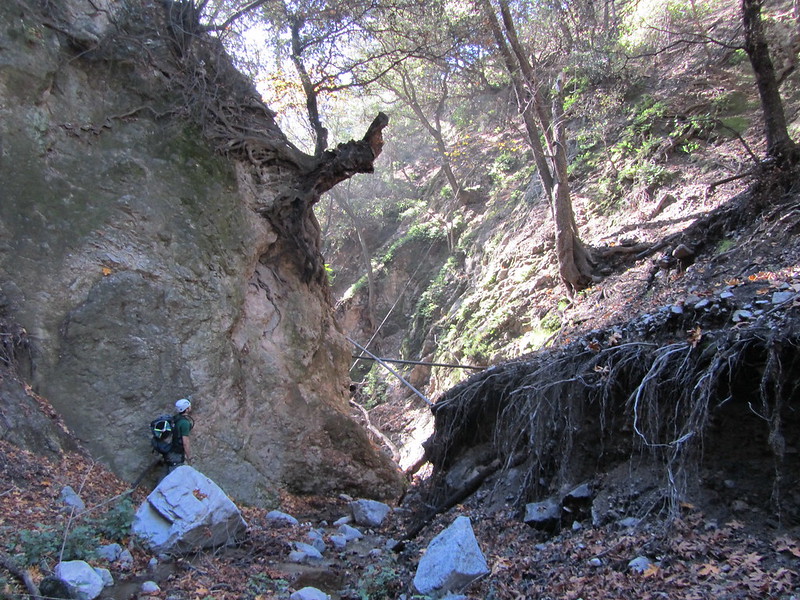
The rock formation was pretty neat. It was the classic molar poking up out the ground with a overhanging ledge that created a "cave" if you will. There was dry creek bed nearby that always seems to be a part of the recipe for a Chumash site. I hoping to find some mortar holes drilled in the rock. I didn't find any mortars, but I did find two paintings on the underside of the aforementioned overhang. 


Now these have the look of Chumash paintings. And the location lends itself to be a good site for Chumash  rock art, but I have some real doubts about the authenticity of these particular paintings. First off the lower painting is orange. That's not a color I know the Ventureño Chumash to have ever used. There are some sites up in Kern county like Pleito Cave that used orange pigment, but red, white, black are the colors I'm familiar seeing here in Ventura. Maybe it's red pigment that has aged strangely? It seems unlikely to me.

The upper painting is much more like something I would expect to see here. The red pigment is very much like other rock art sites I have visited. Referencing Campbell Grant's The Rock Paintings of the Chumash (figure 68), the diamond pattern and concentric circles are design elements that were used by the Chumash. But the sharpness of the "X" in the center just seemed a little unauthentic to me. If it had been there by itself I probably would  have believed that I had found a genuine Chumash pictograph. However, with my skepticism of the lower painting's origins I feel like this might not be an ancient Chumash painting either. But I'm not an authority on these things, I'm just some guy who likes to hike and explore.

If you know anything about this painting one way or the other I would love here about it. Also feel free to give your two cents in the comment area below.


Tuesday, June 30, 2020

Animals In The Forest

I’ve been trying to remember all the different animals I’ve seen while out hiking over the years. I thought I should list some of them here.

Mountain Lion: I once saw a mountain lion from quite a distance away. I was up at Bitter Creek doing a fence removal project when someone spotted it running on along a ridge. I can’t quite remember how far away it was, but I do recall being impressed by the speed it was moving at, and the overall length of the cat.

The other encounter I had with a mountain lion was while camping at the Sespe hotsprings. I was sound asleep when I was startled awake by the most bloodcurdling scream I’ve ever heard. I sounded like someone was being murdered right next to me. But when we did a roll call nobody fessed up to screaming  or claimed not to have heard it all. None of us had any idea what it could have been. I didn’t get much more sleep that night and when morning finally came around I was ready to get out of Dodge. I don’t believe in ghosts, but I’ll confess, I was spooked out. I wasn’t until a few weeks or months later that I saw a youtube video of a mountain lion screaming and it sounded just like what we had heard that night.

Bobcat: I’ve seen bobcats a few times. I always seem to see them while driving on the road. I remember seeing one pop out in front on Portrero Seco road, and I think I’ve seen few on Goodenough Road on the way up to Tar Creek.

Kangaroo Rat: One of the first times I hiked to Tar Creek I remember seeing this weird little creature pop up and it started hopping across the trail like a kangaroo. I had no idea what it was the time.

Bats: Bats are everywhere. I remember a bat flying out of the Chumash cave on Alder Creek and scaring the heck out me.

Bighorn Sheep: Yup, there are bighorn sheep out there. I’ll keep the location where I saw them a secret for now.

This is the best wildlife photo I ever shot

Deer: There are deer everywhere.

Skunk: I like skunks. They’re cool little animals. You can bump into them anywhere in the forest.

Rattlesnakes: I’ve run into lots of rattlesnakes all over the forest. There used to be a really big boy that lived in that rock wall on the Blue Heron Ranch in Matilija. I saw him quite a few times soaking up the sun in the middle of the trail.  They are usually pretty calm and just want to be left alone. A lot of the time they don’t feel like moving off the trail and need to be gently coaxed into getting out of the way. This will often times piss them off. I now wear a pair of snake proof gaiters when I hike off trail alone.

King Snake: I’ve seen a couple of king snakes. I like them because they are easily identifiable, and they are not venomous. Most of the king snakes I’ve come across are the white black variety, the common king snake. But once in Santa Paula Canyon I saw a colored one which I think was a California king snake.

An ensatina from a trip to Rowe's Gulch in Santa Barbara

Salamander: I’ve seen plenty of salamanders. Usually they’re pretty small, about the size of a finger. But I remember seeing one at  Seven Falls in Santa Barbara that was huge (by salamander standards). He was hanging out in the bottom of a narrow but deep (5ft?) pool. I want to say it was a foot long, but it was probably more like 8 to 10 inches long and pretty stocky. 

Arroyo Toad: I believe I saw an Arroyo Toad once at Hard Luck Camp.

Tarantula: I remember camping in Matilija once and swarm of tarantulas came crawling down the canyon around dusk. We’re talking hundreds of them. It was the stuff of nightmares if you’re an arachnophobe.

Glow worm: I saw a Pink Glow worm once camping. Where were we camping? Willett? I can’t remember now.

Condor: The venerable symbol of the Los Padres. From Bitter Creek to Hopper Mountain to The Sespe I have had the honor of seeing quite a few California Condors. They are gigantic. I like it when I’m out on hike and a enormous shadow swoops over me, I look up and a condor is circling overhead. A lot of people tell me condors are ugly birds. I guess everyone is entitled to an opinion. But I think they’re awesome. I’ve looked into condor’s eyes and seen that they are thoughtful, intelligent animals. I remember once laying down for some rest in the Stone Corral after some strenuous hiking when a condor started circling above. I thought, “Oh it’s hoping we’ll die soon so it can pick our bones.” And I thought that was lovely.

Camel and Zebra: This is a weird one. But I swear, once I was out hiking, I think it was on the Sespe probably near the Willett hot spring, but I’m not completely sure of that. When I saw a guy leading a mule train that consisted of a camel, a zebra, and a horse. Sometimes the Los Padres surprises you.


Animals I have not seen

Bears: I have never seen a bear in the wild. They’re supposed to be all over the place. I’ve seen tons of bear shit, and lots of bear paw prints, but I have never actually seen a bear in the forest.

Eagles: I have never seen a Bald Eagle nor a Golden Eagle. They are both supposed to making  a comeback in the Los Padres but again I have never seen one.

Pig: I have heard that invasive wild pigs are running around in the forest, I have never seen one.

Beaver: I also heard that beaver used to live on the Sespe. What a treat it would be to see one of those little guys swimming around building dam.

Sasquach: I know this hairy bastard is out there, lurking in the shadows.

Feel free to leave a comment or a story about an animal you've seen out in the forest. 

Wednesday, May 13, 2020

Matilija 05-01-2020


In the Los Padres there always seems to be something new to uncover. Maybe it's a unexplored creek, or a mysterious cave that has eluded discovery. There's always a new adventure waiting for you. But there are also hikes that are enjoyable no matter how many times you do them. Matilija is one of those hikes. It's the comfort food of Ventura Los Padres hikes. Like a bowl of Mac n' Cheese Matilija is always simple, straight forward, satisfying, and it's good warm or cold.
In order to get to the trailhead early enough to be one of the first on the trail I decided I had to wake up at 4:30. I was out of the house at 5:30. And the drive from Thousand Oaks got me to the trailhead at 6:40.
Some things have changed since the last time I hiked Matilija. There’s been a lot of development to the area right next to the parking area. Walls have been put up and new buildings have been constructed.

 The first crossing
Immediately after that area was the first water crossing. This proved to be the most challenging crossing of the day.  I did not want to start out my hike with wet socks so I had to figure out a dry way across. Usually there’s a rock bridge or fallen tree branch to cross, but today there were none. I went up creek a few hundred feet but was rebuffed by even deeper water. So I went back to the trail  and down creek maybe fifty feet and found a spot I could just barely leap across. 

From there it was easy going. I didn't see anyone else on the trail. It was very pleasant. Somehow I missed the trail split that takes you down to the creek and past the big boulder camp. I ended up taking the trail that switchbacks up the side of the canyon.  At just about two hours after leaving the trailhead I got to West Falls. It was flowing well and the high winds were blowing a fine mist all about.


West Falls
Twenty or so minutes after West Falls, I came to the little spring that trickles out of the canyon wall right before you reach the main falls. I thought that would be good spot to sit down and make a cup of tea and eat some breakfast. While I was boiling up some water on my little wood burning stove a couple of people passed by. After two cups of tea and some Pop-Tarts I packed up and went over the main falls.


  The Main Falls
There's a nice series of 13mm static ropes set up to assist the climb up the wedge to the second waterfall.On the hike back down the creek I of course saw more people. None of them had never been on the hike before. And they all asked me for directions. "Keep going up stream" was the best advice I could really give them. 

Once I made it back to the car I checked my phone, 20,600 steps for the 9.0 mile round trip.
On the drive home a semi-truck had one of its tires delaminate right in front of me providing one last bit of excitement for the day.

Saturday, July 20, 2013

07-06-2013 Lytle Creek


IMG_3948a

 I think this was the most enjoyable San Gabriel canyon I’ve had the pleasure of descending. You will need a permit for this hike. The trail is in the Cucamonga Wilderness, a bit north of the small town of Fontana. To get to the trail-head you have to drive on a bumpy dirt road for a couple of miles. After you park, it’s an 1800 foot hike up to the drop-in point. It took our group about two hours get the drop-in.

IMG_3921


At first there wasn’t any water in the creek bed. Soon after we started going downstream the water started to emerge from the dry ground. It wasn’t too much longer before we reached the first rappel.  I finally got to use the new rope I bought almost a year ago. It’s a 9.2mm Canyon Rope by Blue Water. It’s a bit “faster” than the 9.5mm Sterling Canyontech that we also brought along. 

IMG_3936a
 
The second rappel was the best. It was a two stage rap that totaled about hundred feet. The first drop is about 25 feet. When I got to the edge of the second section I found a large boulder teetering dangerously. I locked off and pushed it off the edge. It hit the pool below with a very satisfying splash.

IMG_3939

I was excited. When I got to the end of the rappel, I had to drop into a little swimmer pothole. I’m over six feet tall and I had to swim a few feet before I could bounce off the bottom. As soon as I hit the water I got a wicked cramp in my right calf. Combining the cramp with a harness loaded with climbing equipment and I was struggling a bit to get out of the pothole. I did get out though, and I stretched out my cramp.  The next person came down, and then I called up to the rest of the group to throw down another rope so I could proceed to the next anchor and rig up. They threw down a rope that landed in the pothole. I jumped into the water again to retrieve it. This time my left calf cramped up. This was the most painful cramp I think I’ve ever had. I had to ask my canyon-mate to help stretch it out. I popped a few S-caps and pounded some water and hoped for the best.
IMG_3944

IMG_3945

A few minutes later I was good to go find the next rappel. We found it a couple hundred yards downstream. This was another rap into water, though not as deep as the previous one. I rigged up my rope and proceed down the waterfall. A few feet down I found myself straining to keep the rope from slipping through my Totem. I had to add some friction on the fly. This was the first time I’ve had to bump up the friction on a rappel. Lucky for me adding friction to the Totem is super easy.  The pool at the bottom was only waist deep.  

IMG_3951


Looking Down the Last Rappel

 There were two more wet rappels and then it was time to exit. The hike out took another hour or so. Thanks again to John C for taking care of the permits, and organizing this trip. Despite the cramps, I thoroughly enjoyed this canyon. I can't wait to do it again.

Friday, July 19, 2013

05-25-2013 Vivian Creek.


Pano - IMG_3809 - web


This was a really fun canyon in the beautiful San Gorgonio Wilderness, just outside of the town of Redlands. A permit is required to hike the trail. The hike to the drop-in point is lovely.  It took us about 45 minutes, and we gained 1000ft in elevation. 

IMG_3806


After we dropped into the watercourse things only got better. Vivian Creek was clear and cool. The water was the perfect temperature for hot day.

IMG_3819

The rappels were really fun. On a warm summer day rappelling through the water is rejuvenating. We had to build on anchor, and we replaced a few oversized rapids at a couple of the anchors.

IMG_3840

IMG_3895

IMG_3857


IMG_3899

This was a very nice canyon with great views of the San Gorgonio Wilderness. I’ve got to thank John C for getting the permit and organizing the trip. It was a adventure I look forward to doing again in the future.

Friday, February 8, 2013

01-16-2013 Classic Canyon and Fall Creek

 Fall Creek right above the shadow.

This day of canyoneering started out good, became terrible for a little bit, then got back to being really fun; I’ll explain. I met up with some canyoneers near the junction of the Angeles Crest Highway and Big Tujunga Rd. The main canyon we wanted to go down was Fall Creek.  Instead of taking the fire road described in Brennen's guide, we agreed that taking Classic Canyon down to Big Tujunga Creek would be more fun.

As a second bonus we decided to take a little known canyon dubbed Camp Five down to Classic Canyon. Camp Five is really just the upper part of Classic Canyon. The drop-in point is just a few steps away from Big Tujunga Rd. We reached the only rappel in Camp Five after about half an hour of hiking. It was a pleasant 60ft drop through a lightly flowing waterfall. Looking up the waterfall from below I thought to myself, “This is a lovely way to start the day.”

Not too many people travel this canyon. This anchor station was pretty overgrown.

That's me coming down the only rappel in Camp Five. Photo courtesy and copyright Mark C.

The fun didn’t last for long. Immediately after the waterfall the canyon got choked up with brush. Since I wasn’t carrying a rope I thought I might as well take the lead and try to break the brush for everyone else. That was a mistake on my part. The following hour was spent fighting (kicking!) thorny vines, ducking fallen branches, and trying not to break an ankle in hidden holes. Somewhere along the way I looked down and saw an old can half-buried in the ground. I picked it up and examined it. It was an Aspen Soda can. Pepsi stopped making that stuff back in 1982. So that can had been sitting in the canyon for the last 30 years. I stuffed it in my bag to take it back my collection of old cans I’ve found on my hikes through the years.

Looking back at Camp Five Canyon. I shan't be going there again.

Camp Five ends where the watercourse intersects with the fire road. We walked down the road a few hundred yards until we found a nice spot to drop into Classic Canyon. Classic gets some traffic, so the going wasn’t nearly as difficult as Camp Five. In fact, it was back to being a nice hike again. There was a nice cold, little trickle of water in the canyon now. The second rappel in Classic terminates in a small pool with thigh deep water (I’m 6’3”). It was a nice warm day so the water was refreshing to me. However, had we started with Classic first thing in the morning it might have been a bit cold for just regular hiking clothes. I was wearing 3mm booties and canyoneering boots to keep my feet warm. The last waterfall in Classic was a beautiful 160 footer.


It was a short walk to Big Tujunga Creek from the last waterfall in Classic. We stopped and ate some lunch. Then we hiked up creek until we crossed the fire road again. From there we took the fire road up to a deep bend towards the back of Fall Creek and dropped into the canyon.

Trekking up Big Tujunga Creek. Photo courtesy and copyright Mark C.

Just a single bolt here.

Fall Creek is a nice wet canyon.  On a colder day I would say a wetsuit might be in order, but this day was sunny and warm, so neoprene for my feet was all that was necessary. I really enjoy rappelling through water. The exhilaration from the water splashing me in the face combined with dangling from a single line in the middle of a remote and beautiful canyon washes away the stresses of urban life. On the taller waterfalls I like to stop mid-rappel for a few seconds and try to soak in the moment.

Dropping into the second and third waterfalls. Photo courtesy and copyright Mark.


The first rap in Fall Creek is off a single bolt. When we got to it we found a pathetic little piece of cord set up in an attempt to back up the bolt to a bush. The bolt looked solid enough for a 25ft rap, so we didn’t bother with trying to back it up.


The last waterfall of Fall Creek

Fall Creek is a pretty quick canyon. There are four rappels stacked up fairly close to each other. Bolts have placed on the third waterfall since Brennan last updated.  A capable group like ours can make it through in just a couple of hours. After finishing Fall Creek there was really only one thing left to do, hike back up to the cars. This is a long, not fun, slog of a hike. But we eventually made it back to where we had started. I really liked this group; everybody had a good attitude, and was fun to hang out with. I’d really like to hit up some more canyons with these folks again if I can.

Sunday, December 16, 2012

12-08-2012 Hall Beckley Canyon

I've been going down to the Angeles National Forest a lot recently. On this day I drove to La Canada/ Flintridge to meetup with a few other canyoneers to explore Hall Beckley Canyon. Christopher Brennen describes a car shuttle in his guide to this canyon. I can tell you definitively that the shuttle is not the way to go. There is a fire road you can hike that starts at the exit point/parking area, and goes all the way up to the drop in point. Our group split up with one half hiking the fire road, and the other half (mine) driving up the Angeles Crest Highway to the drop off point described by Brennen. The trail up was in good shape, and pretty nice. When we peaked out we got a nice view of the cities.

Pano - IMG_3522 - web
A view of La Canada/Flintridge from the Mount Lukins fire road

When we made it over to the drop-in point we found that the other group had beaten us there by a good ten minutes. The fire road is the route to take. When we finished the canyon these guys would be able to hop in their cars and drive away, while someone from my group would have to drive me back to my truck parked on the side of the highway twenty minutes away. The shuttle is just a waste of time and gas.

Pano - IMG_3534 - web
Dropping into the canyon
 
We geared up and dropped into Hall Beckley. The first thirty minutes are a steep decent down a use trail. The first rappel was a short one anchored with some webbing that should probably be replaced soon.

IMG_3538
The first rappel

IMG_3539

 That webbing doesn't look too good

The next few rappels and down-climbs were pretty straight forward. There was webbing already in place at all the raps. Some of the webbing looked a little sun bleached and might need replacing soon. The biggest rappel in the canyon is 140ft with five ledges before you get to the bottom.

IMG_3546

IMG_3551

IMG_3563
The large multi-step rappel 

After the next rappel there is a cave on the the left hand side of the canyon. I only crawled in about 10, but it goes back about 75ft before it's closed off by a man made wall. After the cave the battle to keep my shoes dry became futile. We started to see a lot of piping and cable that has been long forgotten by the water company.

IMG_3574

IMG_3580
Steel cable ladder

IMG_3576

Brennen has eight rappels listed in his guide, but we had to rap eleven times. The wire cables he describes as being down-climbable are no longer viable. After we climbed down a couple of debris dams it was a short walk to the quiet neighborhood that we had met at in the morning.

IMG_3592

IMG_3594

IMG_3596
The first and bigger of two debris dams

One of the members of our group, Jason, runs a neat canyoneering  resource called uCanyon. The site has all kinds of canyoneering information. One thing Jason does is make these awesome illustrations of canyons with all the information you need. Here's the one he made for Hall Beckley: