Sunday, December 16, 2012

12-08-2012 Hall Beckley Canyon

I've been going down to the Angeles National Forest a lot recently. On this day I drove to La Canada/ Flintridge to meetup with a few other canyoneers to explore Hall Beckley Canyon. Christopher Brennen describes a car shuttle in his guide to this canyon. I can tell you definitively that the shuttle is not the way to go. There is a fire road you can hike that starts at the exit point/parking area, and goes all the way up to the drop in point. Our group split up with one half hiking the fire road, and the other half (mine) driving up the Angeles Crest Highway to the drop off point described by Brennen. The trail up was in good shape, and pretty nice. When we peaked out we got a nice view of the cities.

Pano - IMG_3522 - web
A view of La Canada/Flintridge from the Mount Lukins fire road

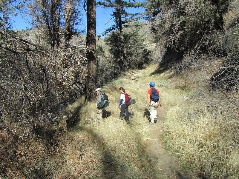
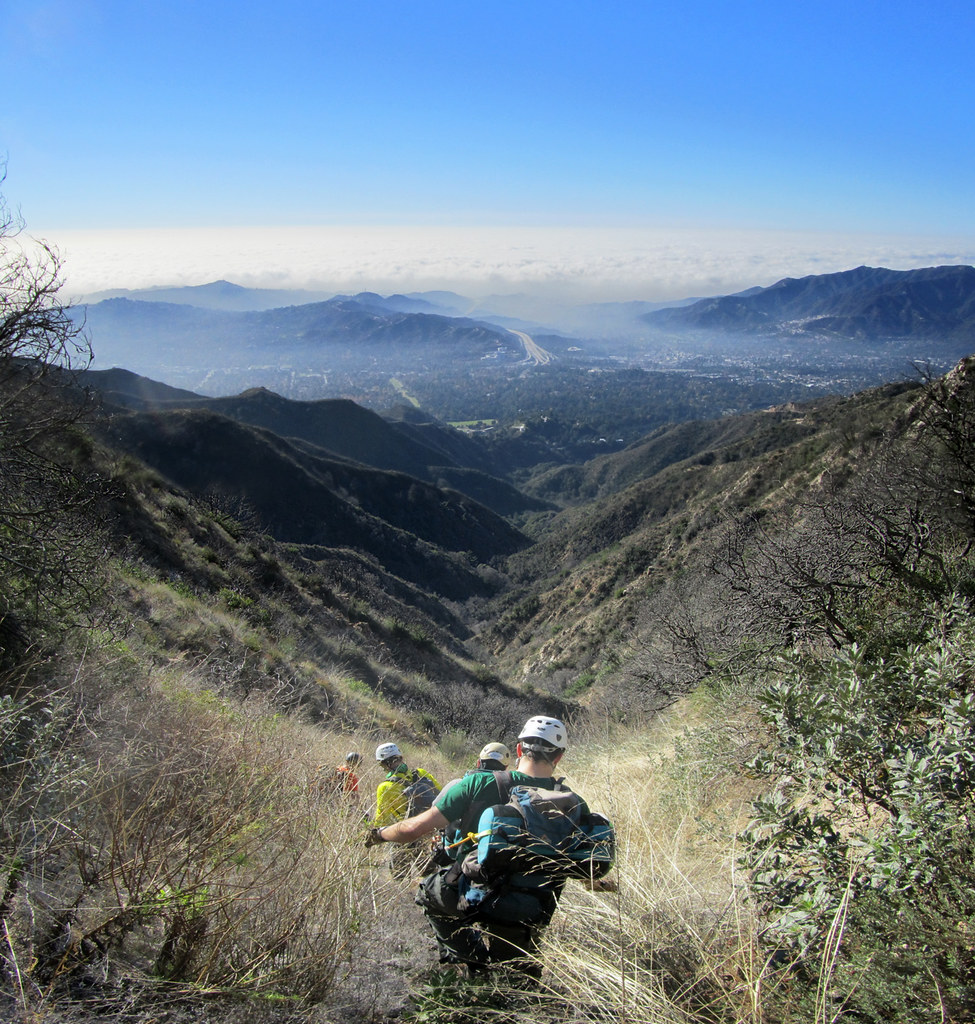
When we made it over to the drop-in point we found that the other group had beaten us there by a good ten minutes. The fire road is the route to take. When we finished the canyon these guys would be able to hop in their cars and drive away, while someone from my group would have to drive me back to my truck parked on the side of the highway twenty minutes away. The shuttle is just a waste of time and gas.

Pano - IMG_3534 - web
Dropping into the canyon
 
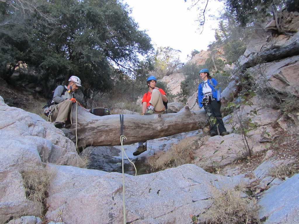
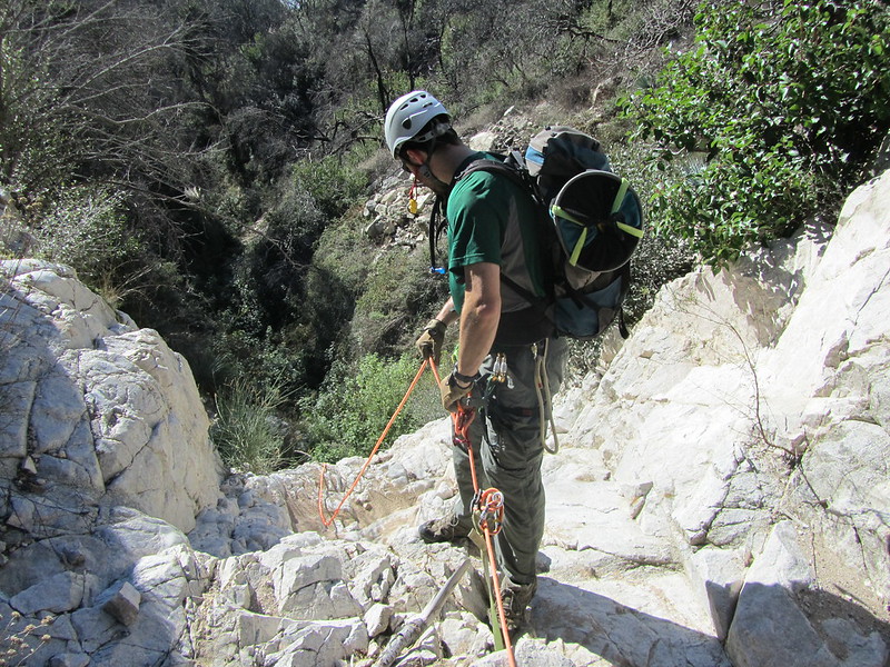
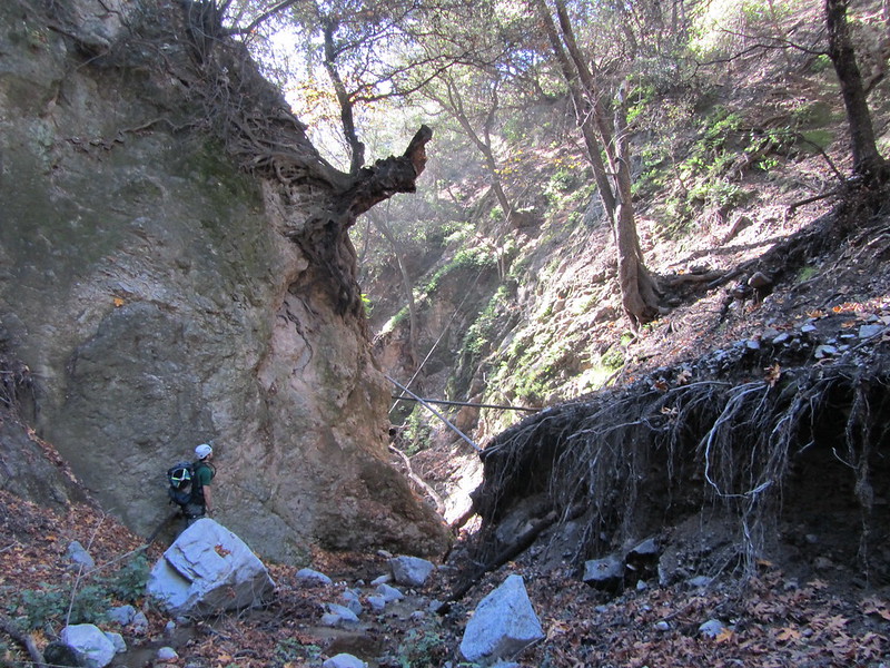
We geared up and dropped into Hall Beckley. The first thirty minutes are a steep decent down a use trail. The first rappel was a short one anchored with some webbing that should probably be replaced soon.

IMG_3538
The first rappel

IMG_3539

 That webbing doesn't look too good

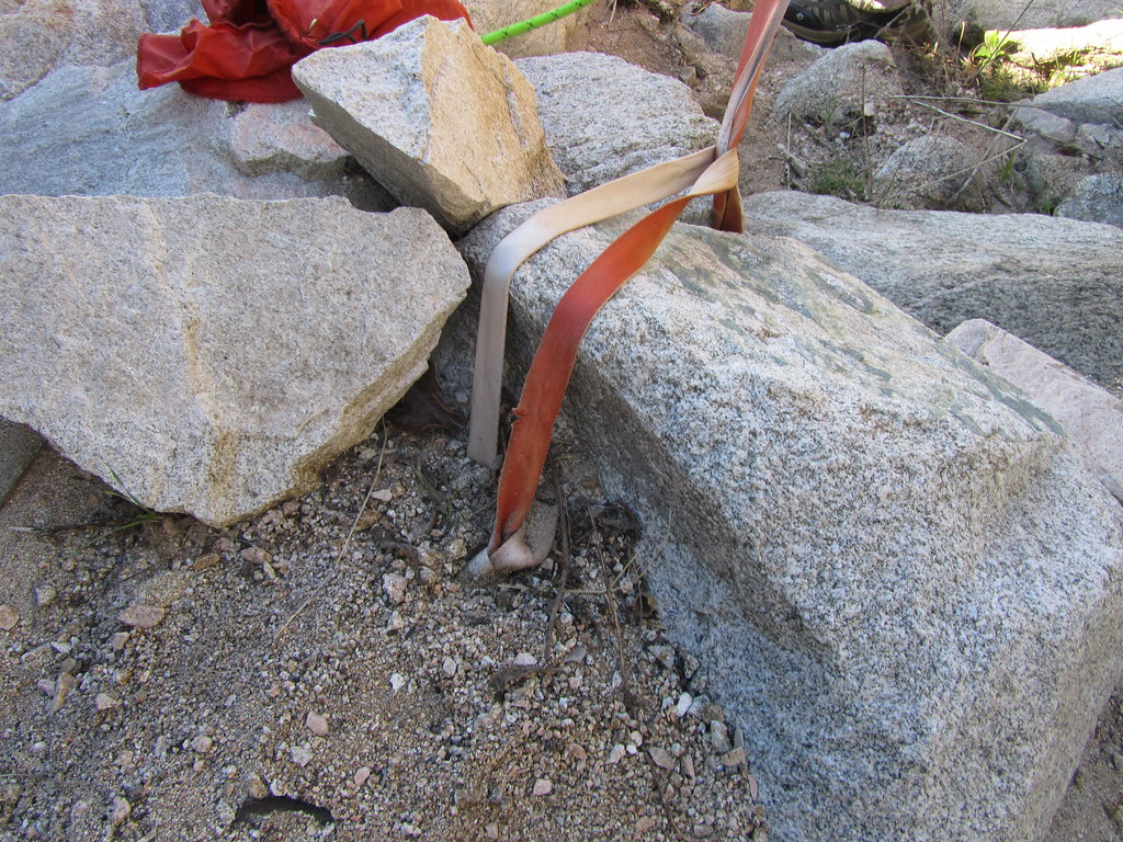
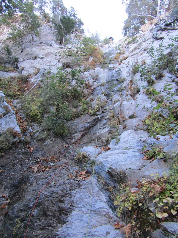
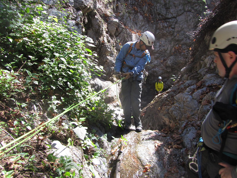
The next few rappels and down-climbs were pretty straight forward. There was webbing already in place at all the raps. Some of the webbing looked a little sun bleached and might need replacing soon. The biggest rappel in the canyon is 140ft with five ledges before you get to the bottom.

IMG_3546

IMG_3551

IMG_3563
The large multi-step rappel 

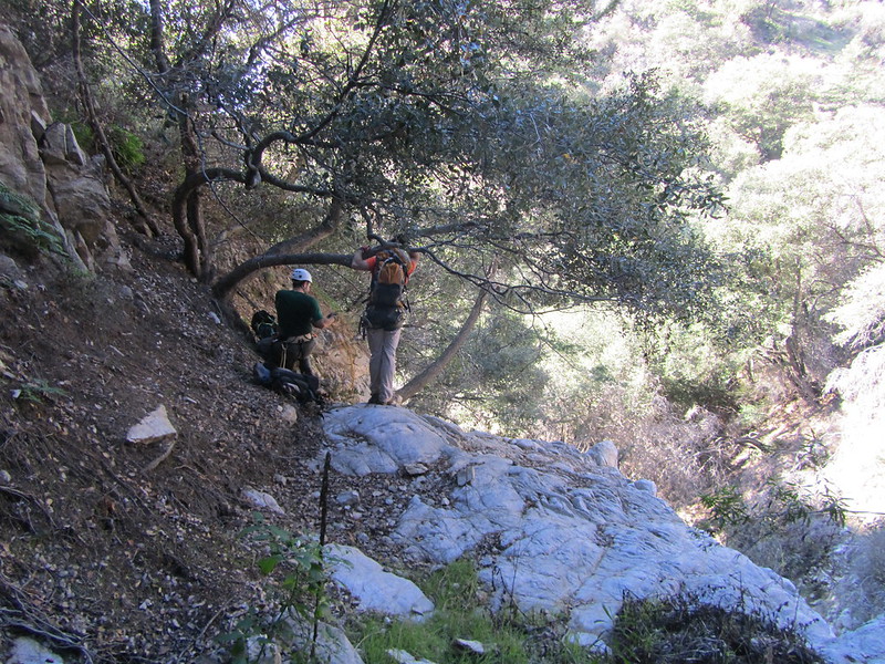
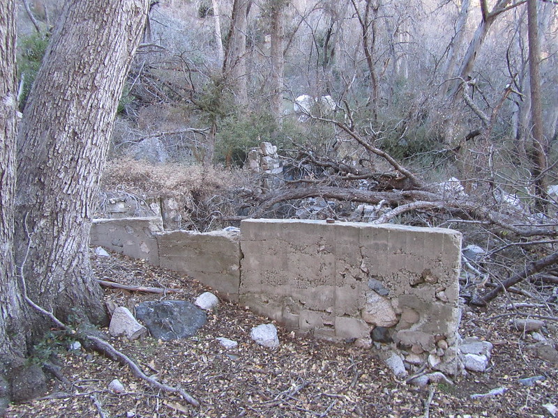
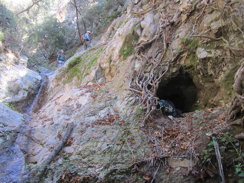
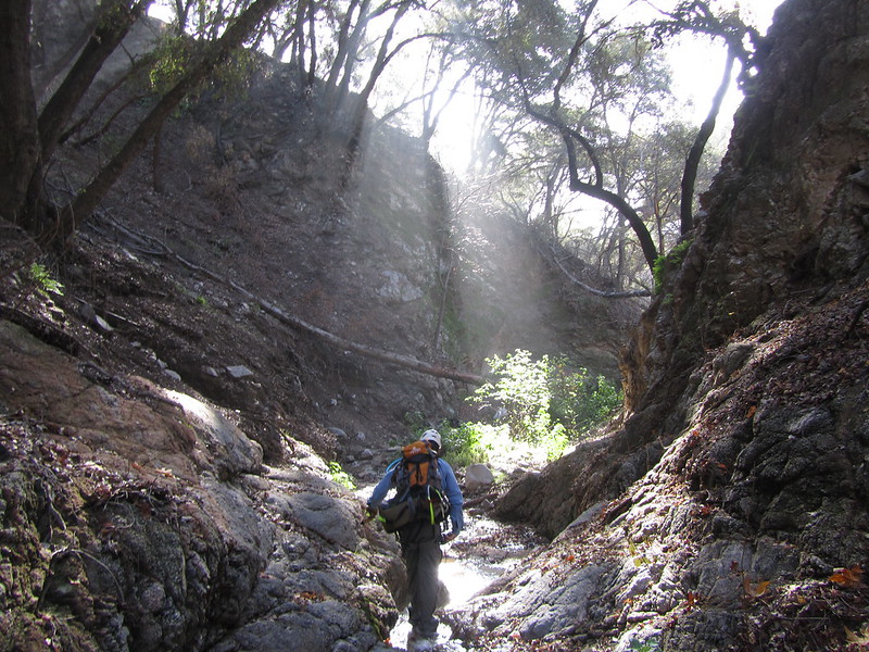
After the next rappel there is a cave on the the left hand side of the canyon. I only crawled in about 10, but it goes back about 75ft before it's closed off by a man made wall. After the cave the battle to keep my shoes dry became futile. We started to see a lot of piping and cable that has been long forgotten by the water company.

IMG_3574

IMG_3580
Steel cable ladder

IMG_3576

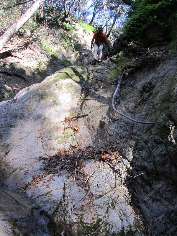
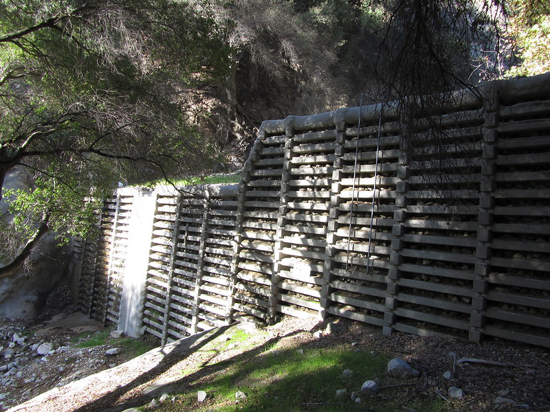
Brennen has eight rappels listed in his guide, but we had to rap eleven times. The wire cables he describes as being down-climbable are no longer viable. After we climbed down a couple of debris dams it was a short walk to the quiet neighborhood that we had met at in the morning.

IMG_3592

IMG_3594

IMG_3596
The first and bigger of two debris dams

One of the members of our group, Jason, runs a neat canyoneering  resource called uCanyon. The site has all kinds of canyoneering information. One thing Jason does is make these awesome illustrations of canyons with all the information you need. Here's the one he made for Hall Beckley:

Wednesday, November 28, 2012

11-24-2012 Supercloud Canyon

I was lucky enough to have the opportunity to work off some of the excess Thanksgiving calories this weekend in a canyon. Located in the Angeles National Forest, cut into Mount Disappointment is a shady, pleasant canyon dubbed Supercloud Canyon by Christopher Brennen. I met up with with my fellow canyon-mates at the Switzer Trailhead along the Angeles Crest Highway. This trip requires a car shuttle; so we left a car on the side of the road near our exit point, then we managed to fit six more people into my truck and we drove up just past the Red Box Ranger Station to start our hike.

The approach to the drop-in point is an easy 45 minute walk up a gated Forest Service road to a use-trail that takes you to a steepish scree slope. Dropping into the canyon was a simple affair. The scars of the Station Fire are still visible on the larger trees.


Debris Dam


After maybe a 10 minute walk we came to the first rappel. Like the previous two canyons I've done, this one has been bolted since Brennen last updated his beta. After inspecting the webbing and bolts, we proceeded to rap on down.

Getting ready for the first rap

After the first rappel things proceeded quickly. The next station was just a short walk down canyon. We had a couple of ropes, so we were able to rig the next rap as soon as a couple people got down. And that's how it went. The two rappels that weren't bolted were rigged to solid tree anchors, so, no worries there.

 Fireman's belay at the first rappel


 Solid natural anchor for the third rap

Yeehaw!
IMG_3494
A nice fallen tree anchor for the last rap

IMG_3496
Looking up at the last rappel


There was a trickle of water at the last waterfall. It was just enough to keep the moss moist, my feet did not get wet. After the last rappel it's a bit of a walk to the highway. There's a decent trail with a bit of rock hopping here and there. There were a few pools of water along the way. There are the remains of a concrete structure just past a debris dam. We got a little mixed up trying to find the use trail back to the cars but after a few backtracks we figured it out.

IMG_3502
Did somebody live here at one time? Maybe it was related to the nearby debris dams?

IMG_3506
 After crossing a little log bridge be ready to turn left down this use-trail.

This was a fun little canyon. I really enjoyed the company of my fellow canyoneers. I hope we can meet up and do another canyon soon.
A view of Los Angeles from the Angeles Crest Highway

Tuesday, November 27, 2012

11-11-2012 Stoney Point Park


Over the last year, I've attended a couple of canyoneering classes at Stoney Point Park in Chatsworth. This park has long been a training ground for climbers preparing for grand adventures, as well as being a place for locals to get in a few boulders after work. It's popular because there are a million different challenges in the sandstone boulders that are scattered about the small park. You can practice in a natural environment without putting yourself at too much risk of catastrophic injury. Ventura icon, founder of Patagonia, and Black Diamond Equipment, Yvon Chouinard practiced at Stoney Point in preparation for his famous ascents in Yosemite back in the 1960’s. Some of Chouinard's partners, like legendary climbers Royal Robbins (who also founded a outdoors equipment company), and Bob Kamps, along with many others have honed their skills at Stoney Point.

One of many house sized boulders

Our classes have always started underneath this centurys old oak dubbed, "The Tree of Knowledge"


Thursday, October 18, 2012

10-13-2012 Suicide Canyon

Big Tujunga River

For this adventure I again had to leave my familiar Los Padres NF and head over to our neighbor, the Angeles NF. I was going to go on another technical canyoneering  trip.  The canyon for the day was Suicide Canyon. It’s one of many canyons cut into Mount Lunkins and drains out in to the Big Tujunga River. If you are interested in any of these canyons, the guru of southern California canyoneering, Christopher Brennen, has excellent descriptions on his website.

Through early morning fog I see visions of the things to be

I met up with my canyon-mates at the Stonyvale parking lot at 7:00am. We didn’t waste much time before started out on the use trail to the canyon. What kinda sucks is right off the bat, I mean within 50 yards of the trailhead you have to cross the Big Tujunga River. The river was calm and nice, but there was nowhere to cross without getting your feet soaked. Everybody else just charged across, so I did the same. You have to cross the river again another hundred or so yards down the trail. From there you don’t get wet again until you’re in Suicide’s watercourse. I would suggest wearing a pair of sandals or something until you get past the river crossings, then put on your boots; your feet will thank you.
Crossing the Big Tujunga River

The Maxon Route

We took the Maxon route as described in Prof Brennan's guide. It’s steep and the tread was loose. There are patches of poison oak so you have something to focus on other than your footing. After climbing a few hundred feet we passed some power lines. A little past that, there was a slightly narrow ridge that was easily passed. Then the ‘trail’ got a lot more overgrown. We basically just bushwhacked our way over to the canyon.


Once we had dropped into the canyon we geared up. We followed a small trickle of water down a few yards to the first challenge, a 200 ft. waterfall named, ‘Lovers Leap’.  In his guide, Prof. Brennan uses natural anchors for all his rappels. In the time that has passed since he published his guide, someone (I'm guessing Matt Maxon) has installed bolt anchors at all but one of the rappels.

Overlooking 'Lovers Leap'

Coming down 'Lovers Leap'. Photo courtesy and © Andre

The first rappel of any canyon is always an introspective moment for me. Have I forgotten to secure something? Am I on the right line? Do I really want to do this? A lot of questions race through my head. A big one is, am I about to die? But I go through my mental checklist, ask somebody else to check me out, and when I get the thumbs up, it's time to go. After you really lean back and let the rope take the load and you don't tumble to your death on the jagged rocks below it becomes a fun experience.

Photo courtesy and © Andre

Photo courtesy and © Andre

Down at the bottom I soon realized another danger; falling rocks. The whole way down the canyon we were sprinkled with loose rocks from above. Belaying was particularly risky. At one point I had to duck out of the way of a face shattering, golf ball sized rock that had been dislodged by the person I was belaying. 


 Photo courtesy and © Andre

The rappels kept coming precipitously; we never had to hike far before rigging up again. Once a few of us would get down, we would take a rope and try to find the next anchor while the rest of the group came down. Most of the rappels were fairly tall. There were a least a couple that were in the 80-100 ft. range. 

 Posing for a picture

... I can take or leave it if I please
 
After a few hours we made it down the last rappel. I would suggest that if you decide to pack up your gear here that you keep your helmet on until you completely leave the canyon. Those rocks I mentioned before were still raining down on us as we made our way back to the Big Tujunga confluence.   

Wednesday, October 10, 2012

10-06-2012 San Antonio Creek

Looking down San Antonio Creek

It’s been just too hot the last few weeks for fun hiking in the Los Padres. But I still want to get out on the weekends and do stuff. What would be really nice is if I could find somewhere within a few hours’ drive that has some nice clear flowing water.

Navigating the use-trail 

I got an invitation through Meetup.com for a canyoneering trip through San Antonio Creek. According to Brennan's description not only would there be water but I should expect to get wet in the lower waterfalls. Whoot! That’s just what I want, so I signed up. 


The drive up Mount San Antonio (commonly known as Mt. Baldy) was pleasant enough. Mt. Baldy is the highest peak in San Gabriels, topping out at just over ten thousand feet. I got there around 8:30 and parking was already an issue. I got lucky though, and found a spot near the trailhead. I had arrived about an hour early so I got my equipment organized and ate some snacks.

 Fireman's belay 

At 9:30, I met up with the other eight canyoneers. We went over the basic game plan for the day and then headed out. In Brennen’s guide he hikes up 2000ft to an old ski hut before entering the canyon. Instead of that route we opted to take a use-trail up to the top of the second waterfall. This shaved about three hours and only one 60ft rappel off the trip. I measured the water temperature at a refreshing 52F. The first rappel was just a few yards down from where we got geared up. There are bolts and webbing at all the waterfalls. From what I gathered, a local guide company visits this canyon frequently and keeps the anchors maintained.


 Getting close to the end

 
The last waterfall 

Everything was pretty straight forward. Find the anchors, rig up the rope, rap down, pull the rope. The flow wasn’t heavy, but getting wet was unavoidable, not that I tried. The third rap was the best. It is an 80 footer that pelts you with water for the lower 60ft. When we got to the last waterfall we had an audience. A lot of people just hike up to the bottom of these falls and hang out. We all made down without any complications. We were a bit wet, but I think everyone enjoyed the soaking. After that it was just a short walk down hill to the parking area. I had a good time meeting all these new people and having a little adventure with them. Hopefully we can do it again sometime soon.