
I haven't been camping in a long time. I also haven't been on a really long hike in awhile. The weather has been good, so I thought it was high time to get out for an overnighter. Frank, Zach, Cara, and I decided to start out at my favorite trailhead, Dough Flat, and then make our way up to Alder Creek. The day before we left I called the Forest Service and asked them if the road was open all the way to the trailhead. They told me, no, it's closed at Tar Creek (a few miles from the TH) because of a three foot deep mud puddle in the road. Well that was too bad but it wasn't going to stop us. Actually I didn't tell anybody about the gate until we got to it. The closed road was dry, bone dry, of course (thanks a lot Forest Service).

It took about an hour and a half to get to the Dough Flat TH. Half an hour later and we were at the Squaw Spring guerrilla camp. Another two hours and we were at the Bucksnort junction. Soon we passed Cow Spring and the Stone Corral.

The trail then descends down a large hill. About half way down the hill is Dripping Spring. This also marks the beginning of the poison oak. We ate lunch and refilled our bottles. Then we made our way down the rest of the hill. At the confluence of the Alder Creek East Fork and a no-name creek the trail becomes much, much harder to follow. Frank and I had been up this trail before, a few years ago, so we kinda knew where to go. Still finding the trail was difficult. Up and down hills, through dried up creek beds, across mesas, then up a poison oak lined creek.

Finally after eight hours of hiking we saw the giant Oak that marked our campsite. We didn't really have time to rest. We had to get our tents set up and gather some firewood before the sun went down in an hour or so. Once we got the campsite set up properly we threw a couple of Bristol Farms porterhouses on the grill and sipped Laphroaig 10 Year Old.

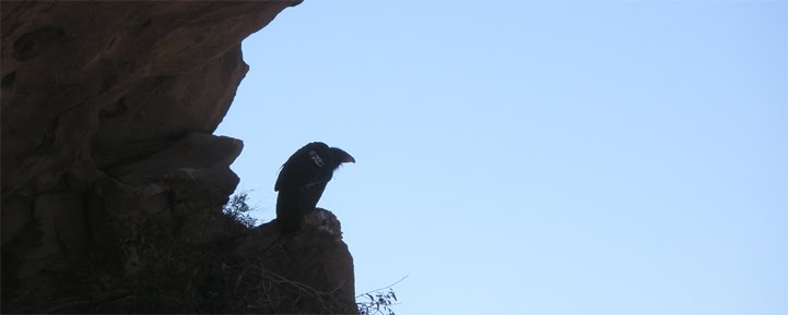
The morning was a bit chilly. But things warmed up once the sun was able to angle over the canyon walls. We packed up our stuff and got ready to leave this rather unremarkable campsite. Instead of going back the way we came, we opted to go down Alder Creek directly. I wore my Canyoneers and 3mm neoprene socks. North of the Sespe you will notice that rocks turn from mostly sandstone to a mix of sandstone and granite. The granite can be quite slippery when wet. My shoes preformed well beyond my expectations. Even with water flowing over the granite my shoes stuck to the rocks. Even with sound footing, all that rocking hopping with a heavy backpack can take a toll on your knees.

The creek was pretty nice. The water was about knee deep in most spots. It did get up to my waist in one section. There was only one spot where we had to take off our packs, down climb some slick logs, and then lower the packs.

I think it took about two hours to get to the East Fork / Alder confluence. Then it was just a few minutes before we found Alder Creek Camp. Not much there but a fire ring and an old icecan stove.


There's another small camp a few hundred yards downstream. I don't know if this was an overflow camp at some time, or if somebody just dragged a grill down there from the proper Alder Creek Camp. Not to much further down the creek we found Shady Camp and set our packs down for the day. There was still enough light out to wash some clothes and get a quick bath in the creek. Refreshed we settled down for our second night.


The next morning we took our time packing up. The trail back crosses the creek several times. A some points the trail is the creek itself. We were able to keep our boots on and dry all the way back to Dripping Spring Hill.

Dripping Spring is a real life saver. Right now it's more than dripping, it's really gushing. The spring turns into a flowing creek that links up with the other creeks downhill. The slog up the hill wasn't too bad. Once we got over the peak of the hill it was a rather pleasant hike back to Squaw Spring Camp. There we made camp for the last night of this trip. The next morning we packed up one last time then headed out to Dough Flat and then the dry dirt road to Tar Creek.


Okay, so somewhere along this hike there is a cave. Perhaps it was off in a narrow canyon, or down an old dusty trail, or maybe up a dry creek bed, I'm not saying. In this cave are Chumash pictographs. It's mostly zoomorphic figures, with some geometric shapes scattered about as well. Some are trichrome others are monochrome. In my amateur opinion I'd say that there were several different artists contributing to this cave. Of all the Chumash caves I've been to, this one is my favorite.


As always, I encourage you to leave a comment, or ask any questions you have.
Funny you should mention the misinformation the USFS gave you. This same weekend you were up at Alder I went up to the lower Sierra and called the USFS prior to going to confirm road and camping conditions. Well, the lady I spoke to at the district station gave me no less than three different incorrect bits of information to the questions I asked her. Roads she said were closed were open and campgrounds she said were open were still closed. I was pissed!!!
ReplyDeleteGreat write-up, EP ... hope you didn't drink my bottle of Jack I keep at Shady! Also, if you pick down-stream just a bit from camp, you'll see where engineers took core samples from the narrows just before you get to the Alder-Sespe confluence. This was done when they were still considering damming the Sespe. Crazy.
ReplyDeleteVery tactful re: the pictos; nicely done.
Always nice to take a vicarious hike with you.
ReplyDeleteNice blog. I do a ton of mountaineering in the Sierra and So Cal Mtns, canyoneering in the San Gab's and hiking in the Sespe. Still would like to canyoneer Tar Creek. Just found your blog this morning. I would love to see the Chumash Picto's and glad you protect their location. I visit picto's in JTree, the Sierra and anywhere i can find them. I'd like to hike back there with you anytime, as long as the air temp is under 80F, to see them for myself.
ReplyDelete