
Cherry Orchard Spring
I think the first thing I should say about this trip is that it would not have been possible without Tom and Kim from Habitatwork.com . They do great work organizing volunteers for highly worthy restoration projects in the southern California national forests. Our mission this weekend was to remove a infestation of knapweed that was growing along a section of Sierra Madre Ridge Road. We were able to accomplish this goal with a little hard work from bunch of cool people.
To get there it's a long drive up the 33 toward Cuyama, then a winding, dusty, 26 mile drive into the Los Padres backcountry. We camped at what the Forrest Service calls Painted Cave Campground. According to historians the Chumash called the spot S'ap'aksi. The Forest Service isn't keeping this site a secret, so I'll tell you about it. The topo map even marks the site with, "Petroglyphs" which to me seems kind of counter to the normal Forest Service policy of secrecy regarding culturally significant sites. Also "petroglyphs" seems like the wrong term. A petroglyph is a carving in stone. I guess they might be referring to the mortar holes that dot the rocks. But that's sort of like saying the Louvre has a lot of nice picture frames. Pictograph, the more appropriate word to me, is a painting on rock, but I digress.
This site has horse corral and outhouse and lot of space for camping. The terrain is hilly and slopes downward towards Leap Canyon and eventually the Sisquac River several miles to the south. How would you get here without a car and key to the gate 13 miles from the campsite? You could take the Sweetwater Trail up from the San Raphael Wilderness. The Jackson Trail from Sycamore Camp is another option coming out of the San Raf, more on that trail later. There is another trail that I think is called The Rocky Ridge Trail (the topos don't seem to name it, and I can't remember what the sign said) that goes out of the camp toward Newsome Canyon and Cuyama.
There is a rock formation with Chumash paintings before you get to the FS gate. I'm not going to tell you where it is though. It's very close to road and I'm surprised it's survived this long.

Once past the gate it's a long drive to Montgomery Potrero. I would guess that any large rock formation near a spring has a lot of potential for rock art. You just have to be willing to sweat a lot and take a few risks. A few miles up the road from S'ap'aksi is the Pine Corral. This is a big grassy area used for cattle grazing with rock formations popping out all over the place. If you decide to look for rock art here watch out for the big black bull that lives there with his harem of cows, he can be down right ornery. And while I'm at it when I was down in one of the side creeks looking rock art I came face to face with a rattlesnake. No big deal, it happens all the time. But this one was really not happy to see me. I found out later that it was because Frank had passed by it earlier and picked it up with a stick, thoroughly pissing it off.

An angry rattlesnake
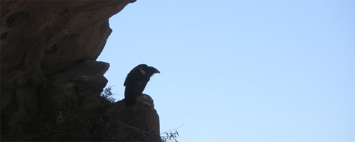
Just past the Pine Corral is Lion Canyon. This canyon is an absolute jaw dropper. It used to be a California Condor release site. There are so many nooks and caves in Lion Canyon I could spend a week there wandering around taking it all in.

Lion Canyon
Then you arrive at S'ap'aksi. At the ground level right next to a trickling waterfall is a painting that I interpret as a dolphin. This is one the largest Chumash paintings I have personally seen. It's been badly damaged, but the head, dorsal, and front fins are still visible. If you go up and behind the rock you can find the little spring that feeds the waterfall. Follow that spring down at will lead you right to "The House of the Sun". Inside the cave you will see a large sunburst painting and few human/ animal like figures. There's a paper online by Georgia Lee and Stephen Horne that gives a lot info about S'ap'aksi, most of it (like all Chumash information) was gathered by Harrington. Like all academic work on the Chumash, I would take it with a grain of salt. I don't think that true full blooded Chumash shared there secrets with non-Chumash. Of course, I'm basing my opinion on information gathered by Harrington, so take that with a grain of salt as well. You can check out a video I took at the site here
If you keep heading up the road another half mile you find a sign that says, "Jackson Trail." Follow that trail another half mile and you come upon a dilapidated cabin. It doesn't look like an old time "historical" cabin but more like a shitty cowboy shack. I took a short video of the place. There is a creek with water right behind the cabin. But that's it, the trail does not continue on to the San Raf from here. Looking at the topo map (Hurricane Deck) the Jackson Trail is the road (Sierra Madre Ridge Road) and the cabin is just a little side trek. I can see how the sign there would be confusing to a hiker. Here's a video.

This cabin looks like it still gets some use
Thanks to a academic newsletter published by a Rock Art Group that is advocating closing off cattle grazing access to about half dozen sites on the Sierra Madre Ridge, I was able to figure out where some of those rock art sites were.

A chipped figure
So thanks again to everyone involved with Habitatwork.org . I had a great time, and really appreciate the opportunity go out and search for these paintings.

This gopher snake owes its life to Tom
Nice trip. I've spent a fair amount of time up that way; Malduce Station & Peak, Buckhorn, Dick Smith, Heath and the Upper Sisquac. Pretty cool area.
ReplyDeleteLiving vicariously through your trips. Keep the postings coming!
ReplyDeleteGreat post and blog! Re: the Jackson Trail, it actually splits off to the West of the dirt road down to the cabin at the San Rafael Wilderness sign. It continues over the grassy field and all the way down to the Sisquoc. A beautiful 4 to 5 mile hike with lots of rock formations and a great payoff at the river. Just watch out for snakes in the tall grass...
ReplyDeleteThe "shitty cowboy shack" as you describe it was actually one of may lookouts built during WW2 to watch for japanese attacks. They did spot at least one of the balloon bombings the japanese sent over. The lookout was moved off of its high location and down closer to the spring after the war. There aren't many of these left. The one on Caliente peak has lost its lookout and may have fallen by now.
ReplyDeleteJim
Okay, "dilapidated" may have been a more mature choice of words. That's an interesting bit of info. I remember seeing some dry food stuffs and some cooking oil inside the cabin, through the window. I didn't want to go inside because I thought it belonged to one of the ranchers up there. But now I'm thinking it's a cabin for hikers? It looked like a rats nest to me. I'd rather sleep outside on the ground. Thanks for commenting, and the information.
ReplyDelete