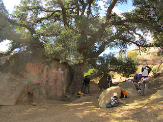
The approach to the drop-in point is an easy 45 minute walk up a gated Forest Service road to a use-trail that takes you to a steepish scree slope. Dropping into the canyon was a simple affair. The scars of the Station Fire are still visible on the larger trees.
Debris Dam
Getting ready for the first rap
After the first rappel things proceeded quickly. The next station was just a short walk down canyon. We had a couple of ropes, so we were able to rig the next rap as soon as a couple people got down. And that's how it went. The two rappels that weren't bolted were rigged to solid tree anchors, so, no worries there.
Solid natural anchor for the third rap
Yeehaw!
A nice fallen tree anchor for the last rap
Looking up at the last rappel
There was a trickle of water at the last waterfall. It was just enough to keep the moss moist, my feet did not get wet. After the last rappel it's a bit of a walk to the highway. There's a decent trail with a bit of rock hopping here and there. There were a few pools of water along the way. There are the remains of a concrete structure just past a debris dam. We got a little mixed up trying to find the use trail back to the cars but after a few backtracks we figured it out.
Did somebody live here at one time? Maybe it was related to the nearby debris dams?
After crossing a little log bridge be ready to turn left down this use-trail.
This was a fun little canyon. I really enjoyed the company of my fellow canyoneers. I hope we can meet up and do another canyon soon.
A view of Los Angeles from the Angeles Crest Highway


