Monday, June 14, 2010

06-10-2010 Tar Creek


The Big Pool, Bear Heaven in the background

Frank and I decided that a day hike to Tar Creek was in order. We figure the water levels will be getting pretty low soon. And as the water heats up with the summer the algae will really bloom.

We got to the lower falls quickly, and easily. I finally worked up enough courage to jump from the 40ft perch. It was the highest jump I've ever done for sure.


Trying to work up some courage

Frank brought my boat, and floated in the big pool for awhile.


Relaxing in style


Snakes in love

A family of nude hikers made their way down from their camp at the cascades. The mom and the kid put some clothes on when they saw us, but dad was not about to cover up. What got me wasn't the lack of clothing, but that they weren't wearing any shoes. You have to be pretty dedicated to your nakedness to walk through the rough, and jagged boulders of Tar Creek without any foot protection. They hung out for a bit, and then they headed back to their camp, barefoot, and bare-ass. We took off shortly after the family did. I think we were both feeling pretty good because we made it up the Tar Creek hill in 38 minutes, a personal record. If you're thinking about hitting up Tar Creek this year, the countdown is on, hurry up. Contact me or leave a comment if you have any questions or anything.

Monday, May 24, 2010

05-16-2010 Sespe Gauntlet


Tar Creek, Sespe, Bear Heaven, The West Fork, Topatopa Mountain

I've been thinking about this hike for a long time. I think it started a few years ago when I was looking around on the internets for info on Tar Creek when I came across Christopher Brennen's web-book. In it he describes a hike that starts at Dough Flat links up with the Sespe at Alder Creek and ends at Tar Creek (or Devil's Gate). The most intriguing part of the hike to me had to be what he called "The Squeezes", three deep pools on the Sespe that had to swam across to be passed. The idea of floating alongside my pack in the Ventura backcountry has fascinated me since I read about it. I know that Frank and Zach had made a sort of ill prepared attempt at this hike ten years ago. Only to be turned back by a raging Sespe and to be driven out of Lions Camp by the late Tony Alvis.


Sleeping Indian Rock

Instead of starting at Dough Flat, I wanted to start at the Piedra Blanca trailhead (Lions Camp)and then camp at Willett Hot Spring, then Sespe Hot Springs, then in the Sespe Narrows, and finally camp at the Tar Creek / Sespe confluence. So, armed with Brennen's directions we headed out for six days of adventure on the Sespe. The hike out to Willett is nothing special. I described it in my last post. What I didn't mention in that post was that we had stashed supply's and eight beers up there. That allowed us enough room in our packs to bring fresh food for dinner the first night. What a meal we had. Frank brought Fillet Mignon (wow!), I brought some Tri-tip and Zach brought Bulgogi. Jeremiah rolled into camp with some fresh veggies.


Zach and Jeremiah grill it up

We had so much food we were able to feed the two other people staying up there as well. One them told us he was a runner in The Coyote Two Moon, a crazy looking race. After diner we headed up to the tub and relaxed with our beers for a bit. The four of us were able to sleep in the bunk beds at the condo that night. In the morning we had a big breakfast and then got ready to head on to Sespe Hot Springs. At one of the creek crossings along the six mile trail to the Hot Springs we ran into a group of upbeat kids from Thacher School. They had spent the night at Shady Camp and were headed towards Willett. What awesome school to go to. We walked past Cottriell Flat. I didn't stop to see if the camp was still there.


Cottriell Flat

Right as we got into Hot Spring Canyon it started to rain lightly. We made our way up to the Hot Springs and pitched camp at spot with a couple of palm trees. Frank measured the temperature, and the hot water bubbles out of the side the canyon walls at 189 degrees Fahrenheit! Right next to the Palm Tree Camp are a couple of one person pools that were a nice 106 degrees, perfect for a nice morning soak. It continued to drizzle rain throughout the night. I was a little scared that we might have to postpone going into the Sespe. The threat of flash floods is real. But the rain was light, and didn't really raise the water level at all. In the morning I got up and took a nice bath in one of the hot pools. Jeremiah earned canyoneer of the week honors for packing out a bunch of Keystone Light cans that some jerk had left behind.


Relaxing in scalding hot water

Right where the Upper Sespe Trail starts to head up over a saddle towards Shady Camp there's a sign that says, "Devil's Gate: 15" this is where you should take off your hiking boots and put on your water shoes (I'd also recommend some heavy wool or neoprene socks).


A good sign

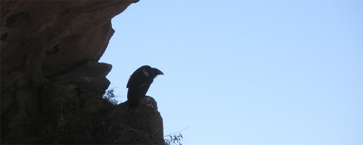
We spent the next five hours walking down the middle of the Sespe. I think trying to find a way through here without getting your feet wet is next to impossible. Slogging through the creek was actually a lot of fun. The water was only about shin high most of the time. After a couple of hours we could feel the cold water of Alder Creek mixing in with the Sespe. We saw our only Condor of the trip circling above the Stone Corral.


Contemplating my next move

Finally we reached the campsite described in Brennen' guide. It's actually not a campsite per say, but more of a beach with a stone fire ring.


Overhang Falls Camp

There was plenty of room for the four of us. The site was so nice, that we decided to spend the next day there too. So we spent our forth day just exploring and swimming in the canyon. Late in the afternoon two other hikers passed through (Jen and Wes? Sorry, I forgot your names). They were real cool, and we would see them a few more times before our trip was over.


Sunset on The Sespe

That night it was really windy. None of us got a good nights sleep. Part of it was the wind, and at least for me, it was partly the excitement of the next days hike keeping me up. We packed up early. I lined my bag with a garbage bag in case I took a dunking in the creek. Soon after we started out, we passed by the two other hikers at their camp. They had had a close call with a falling boulder in the middle of the night, and seemed pretty shaken up by it. We wished each other luck, and our group continued on. The area near the First Squeeze is known as the Sespe Gorge. The power of the Sespe is on full display here.


The creek picks up speed and thunders over the boulders into a narrow chute, the First Squeeze, then spills out into a wide pool. We were able to get through this section without swimming. As a matter of fact we were able to get through all the "squeezes" without swimming. I don't think the water was low, but rather the dep pools had been filled with sediment. I don't know if these will get washed out when a really heavy storm hits, or maybe that's what filled them up. We were all a bit disappointed that we didn't have to float our bags and swim the narrow sections.


The First Squeeze


The Second Squeeze

We had been taking turns carrying my 3lb inflatable boat for nothing. I guess it's better safe than sorry, though. As we trudged on through the Sespe we refilled our bottles with water springing right from the base of Topatopa mountain.


Pure clean water


Approaching the Third Squeeze

The river water got cloudy-er as we neared Grassy Flat. And there's nothing flat about Grassy Flat. It's just a lot of rocks and brush. The West Fork is so overgrown I didn't even notice it as we passed by. When we found several nasty open pits of bubbling oil seeping into the creek we knew we were getting close to Tar Creek.


An open oil pit

As we made our way closer to our camp I turned back to see how everyone was doing. Right at that moment, maybe a few hundred feet away from us and a black jet roared through the canyon at a ridiculous speed, pulled a high-G bank straight up near Tar Creek Falls, did a couple of barrel rolls, leveled out, and then shot off east like a bat out of hell. The sound of it rushing by was incredibly loud, and scared the piss out of me.

Soon after that we got to the two gigantic boulders that I call Patty and Selma. They block the way to Tar Creek. Where they meet in the creek they form a formidably powerful waterfall. The only way past them is to balance your way down a log placed on the east side of the creek. A few minutes later we were at the Tar Creek camp. Like Willett we had hiked in a few weeks before and stashed some beers and food. So that night as we ate up the rest of our freeze dried meals and drank our hard earned beer. We talked about what we wanted to eat when we got back civilization.


The next morning we packed up our stuff for the last time. We made sure our camp was completely clean. My policy is to pack out any trash (within reason) I find in the Condor Sanctuary. Zach dubbed the trail up from the Sespe to Tar Creek the Donkeyballs Trail because it's such a bastard. Jeremiah was able to cut over from the trail to the bottom falls of Tar Creek. We all met up at the Cascades.


Grace in motion

At first we were the only ones there. Jeremiah and I cleaned up the make-shift campsites at the Cascades. We found a bunch of beer cans, a disturbing number of Blow-Pop wrappers, and even an old rope. As we made our way up the Tar Creek hill I kept finding more wrappers and cigarette butts. And then at the top of the hill our ride was waiting for us. A few minutes later Wes and Jen rolled up. We had made it. Thirty some-odd miles (twelve or so in the water)over six days. I thought I would feel totally beat after such a long haul. But to the contrary, I felt supercharged.


So to sum it all up, I had a great time. Despite not having to swim through the squeezes this was a really rewarding trip. We all worked as a team, helping each other out when we needed to. In the past I was proud of making it through the Stone Corral, and "finding" the Upper Matilija Falls was pretty cool, and I've completed some other hard hikes, but this was the most satisfying hike I've ever done. I'd love to try it starting from Dough Flat some time.
Tuesday, May 11, 2010

05-07-2010 Willett Hot Spring

Willett Hot Spring is a very popular and well known hike. It's a pretty straight forward nine mile hike from the Piedra Blanca trailhead. We decided that in preparation for our upcoming Sespe hike we would hike out to Willett and back in one afternoon. We set a pretty good pace. It took us two hours to get Kerr Spring, the half-way point to Willett. Here's a tip, when you get to Bear Camp there's a creek crossing if you stick to the main trail, but if you keep walking down creek on the use-trail about a hundred yards you can rock hop across the creek without having to take your shoes off and wade.


Watch your step

Another two hours and two more creek crossings and we were at Willett Camp. There's a few old buildings. In one of them I found a couple of super-stoned Ojai locals playing Scrabble and chillin on the bunk-bed frames in there. There's a concrete structure with a big, metal, bear-proof door for storage.


Stash your goodies here

We were sitting at one the picnic tables when a well traveled fellow named Scott strolled up.


A nice place for lunch

We chatted about past hikes for about an hour, and then it was time for us to head back the way we came. We didn't even check out the hot spring. I wore my water shoes for the half mile back to the creek crossing only to realize when I got there that I had left my socks drying back at Willett. So I had to run back get my socks and then run back to where Frank was waiting for me. We were able to keep the same pace back, two hours to Kerr Spring. We ran into a guy from the California Conservation Corps who said they had been working on the Red Reef Trail and the trail between Sespe Hot Springs and Shady Camp. So if you had been rebuffed on those trails in the past they are probably improved now. We saw a woman on horseback leading four or five mules loaded with supply's out to the CCC camp at Sespe Hot Springs on our way back. I assume she was from the Los Padres Outfitters.


Checking out that ass

And that was it, eighteen or nineteen miles in eight hours. I counted about nine people staying at Willett that night. Next week we will take six days to hike the Sespe from Piedra Blanca to Tar Creek.

Monday, May 10, 2010

05-01-2010 Lake Casitas Beer Festival

Well, this had to be the least strenuous VCCC trip in the books. But we slept in tents, so, while it might not be canyoneering, or even hiking, I still consider it a VCCC event. First I have to give thanks to everyone involved with Ventura Independent Beer Enthusiasts (V.I.B.E.). VIBE is Ventura's homebrewers club. It's a great group of friendly beer lovers.


We all felt like he looked

I wish I could remember more about the Southern California Beer Brewers Festival. What I do remember is a lot of super nice people from all over with the common thread of loving finely crafted beer. The tasting (drinking) began at 10:30am and I would guess that it stopped somewhere near dawn the next day.


Everybody was having a good time

A lot of the clubs set up really nice booths. There was a group from San Diego that had dozens of taps flowing. The Santa Barbara club was all dressed as Barbeereens. They were wearing black kilts and viking helmets, real nice guys though. I had fun hanging out at their booth shooting the breeze. The Brewing Enthusiasts of the Antelope Valley Region (B.E.A.V.R.) had a great booth. I think they had the best named beer at the event with their "It Burns When IPA" India Pale Ale. They also had a stout called "Chocolate Covered BEAVR Nuts". My favorite beer at the fest was Temecula Valley's Scotch 80. That was a damn fine brew, and I tip my hat to whomever made it.


And I hope you like jammin too


There was much singing and guitar playing around the campfire. I pretty sure everyone had a great time. I met some really cool people that I hope I can hang out with again in the future. Next time I'll drink more water.

If you went to the festival and have any opinions on the beers or the event please leave a comment.

Tuesday, April 27, 2010

04-24-2010 Sespe via Tar Creek


We decided to do the Tar Creek loop this weekend. It's a long, grinding trek with a lot of bouldering. We had done it once before, but in the opposite direction as this hike. We will be hiking the Sespe in a few weeks, and we thought it would be a good idea to check out the last campsite we'll be staying at. So we went down Tar Creek to the big falls at the bottom.


The big falls


Now there are few things I have to say about rappelling off the falls. First off there is no real need to rappel off the falls. There is a trail on the north side of the falls that will take you down to the bottom. Well, most of the way down, then you have to a little bit of scrambling. It may not be as exciting, but it's a million times safer then a rappel. There are some bolt anchors set into the edge of the big falls. Someone had left their nylon webbing behind. I guess they've worked so far, but I don't know why anybody would trust those rusty ass anchors. It looks like the glue-in bolt is okay, though its sister bolt seems to have disappeared somehow. If you just have to rappel down falls there are some fine natural anchors near the edge. But here's the deal, you have to pull your anchors before you leave. That means either bring a pull rope, and retrieve your webbing from the bottom, or leave a person up top that will remove the webbing for you. This is a Condor sanctuary and these falls have Condors bathing and drinking from them all the time. Condors are curious animals and can get wrapped up in old webbing or rope and die. It really saddened me to find out we had lost a Condor last year do to someone carelessly leaving some rope behind at the falls. Don't leave anything behind at Tar Creek, be it trash, food, or rope. These guys did it the right way. Follow their example.

So after I removed the offending webbing we made use of the before mentioned trail to make our way to the bottom. At the bottom the trail disappears and you have to make your way to the Sespe by climbing down a maze of gigantic boulders.


Making our way down to the Sespe


Somewhere between the big falls and the Sespe

Once down to the Sespe it's a short upcreek walk to the campsite. Unfortunately at this time of year the creek is still high enough that we had to cross twice to get to the campsite. And there's not much to it. It's just a flat sandy area framed by some rocks. There is a grill to cook on, but that's about it. Just a few steps upcreek of the campsite there is a cave formed by a colossal boulder that has fallen on two smaller boulders. There's room inside the cave for a few people to sit around a firepit.


The entrance to the cave. Bear Heaven in the background


This is also where the long trail from Tar Creek ends/starts. We managed to walk right past the trailhead, and then spent the next hour trying to find it a few hundred yards upstream. It was a relief to finally find the son of a bitch. Have you ever been to one of those carwashes where the brushes come in from the side and scrub the side of your car? Well this trail is like that, only replace the brushes with poison oak. Along the trail we ran into a couple coming the other way. They said they were trying to get to the Sespe Hotsprings. They said that they couldn't find a map, and were, "just winging it". We told them that it would be impossible to get the hotsprings. I didn't give them any shit about how stupid they were being by going out somewhere without a map or even a clue about where they were. I think they thought they were at Dough Flat. It took us about three hours to make it back to the Tar Creek trailhead from the Sespe.

Monday, April 19, 2010

04-17-2010 Sierra Madre Ridge


Cherry Orchard Spring


I think the first thing I should say about this trip is that it would not have been possible without Tom and Kim from Habitatwork.com . They do great work organizing volunteers for highly worthy restoration projects in the southern California national forests. Our mission this weekend was to remove a infestation of knapweed that was growing along a section of Sierra Madre Ridge Road. We were able to accomplish this goal with a little hard work from bunch of cool people.

To get there it's a long drive up the 33 toward Cuyama, then a winding, dusty, 26 mile drive into the Los Padres backcountry. We camped at what the Forrest Service calls Painted Cave Campground. According to historians the Chumash called the spot S'ap'aksi. The Forest Service isn't keeping this site a secret, so I'll tell you about it. The topo map even marks the site with, "Petroglyphs" which to me seems kind of counter to the normal Forest Service policy of secrecy regarding culturally significant sites. Also "petroglyphs" seems like the wrong term. A petroglyph is a carving in stone. I guess they might be referring to the mortar holes that dot the rocks. But that's sort of like saying the Louvre has a lot of nice picture frames. Pictograph, the more appropriate word to me, is a painting on rock, but I digress.

This site has horse corral and outhouse and lot of space for camping. The terrain is hilly and slopes downward towards Leap Canyon and eventually the Sisquac River several miles to the south. How would you get here without a car and key to the gate 13 miles from the campsite? You could take the Sweetwater Trail up from the San Raphael Wilderness. The Jackson Trail from Sycamore Camp is another option coming out of the San Raf, more on that trail later. There is another trail that I think is called The Rocky Ridge Trail (the topos don't seem to name it, and I can't remember what the sign said) that goes out of the camp toward Newsome Canyon and Cuyama.

There is a rock formation with Chumash paintings before you get to the FS gate. I'm not going to tell you where it is though. It's very close to road and I'm surprised it's survived this long.


Once past the gate it's a long drive to Montgomery Potrero. I would guess that any large rock formation near a spring has a lot of potential for rock art. You just have to be willing to sweat a lot and take a few risks. A few miles up the road from S'ap'aksi is the Pine Corral. This is a big grassy area used for cattle grazing with rock formations popping out all over the place. If you decide to look for rock art here watch out for the big black bull that lives there with his harem of cows, he can be down right ornery. And while I'm at it when I was down in one of the side creeks looking rock art I came face to face with a rattlesnake. No big deal, it happens all the time. But this one was really not happy to see me. I found out later that it was because Frank had passed by it earlier and picked it up with a stick, thoroughly pissing it off.


An angry rattlesnake

Just past the Pine Corral is Lion Canyon. This canyon is an absolute jaw dropper. It used to be a California Condor release site. There are so many nooks and caves in Lion Canyon I could spend a week there wandering around taking it all in.


Lion Canyon

Then you arrive at S'ap'aksi. At the ground level right next to a trickling waterfall is a painting that I interpret as a dolphin. This is one the largest Chumash paintings I have personally seen. It's been badly damaged, but the head, dorsal, and front fins are still visible. If you go up and behind the rock you can find the little spring that feeds the waterfall. Follow that spring down at will lead you right to "The House of the Sun". Inside the cave you will see a large sunburst painting and few human/ animal like figures. There's a paper online by Georgia Lee and Stephen Horne that gives a lot info about S'ap'aksi, most of it (like all Chumash information) was gathered by Harrington. Like all academic work on the Chumash, I would take it with a grain of salt. I don't think that true full blooded Chumash shared there secrets with non-Chumash. Of course, I'm basing my opinion on information gathered by Harrington, so take that with a grain of salt as well. You can check out a video I took at the site here

If you keep heading up the road another half mile you find a sign that says, "Jackson Trail." Follow that trail another half mile and you come upon a dilapidated cabin. It doesn't look like an old time "historical" cabin but more like a shitty cowboy shack. I took a short video of the place. There is a creek with water right behind the cabin. But that's it, the trail does not continue on to the San Raf from here. Looking at the topo map (Hurricane Deck) the Jackson Trail is the road (Sierra Madre Ridge Road) and the cabin is just a little side trek. I can see how the sign there would be confusing to a hiker. Here's a video.


This cabin looks like it still gets some use


Thanks to a academic newsletter published by a Rock Art Group that is advocating closing off cattle grazing access to about half dozen sites on the Sierra Madre Ridge, I was able to figure out where some of those rock art sites were.


A chipped figure

So thanks again to everyone involved with Habitatwork.org . I had a great time, and really appreciate the opportunity go out and search for these paintings.


This gopher snake owes its life to Tom

Wednesday, April 7, 2010

04-03-2010 Middle Sespe Rocks


I wasn't really planning on doing any hiking this weekend, until Friday evening when Megan asked if I wanted to go anywhere for my birthday. For a long time now I've been curious about the large rock formation that you can see in the distance behind the Middle Sespe trailhead. These formations look a lot like the Piedra Blanca formations that lie a few miles downstream. I've wanted to get back there and look for caves and archeological artifacts. Megan, Mike and I started from the mentioned Middle Sespe trailhead right off the 33. Instead of staying on the trail when it first crosses the Sespe we made our way upstream for little bit before we found a small creek that was flowing from the Northeast. We followed the winding little creek up about half a mile where came to some cool look rocks that were framing the creek. These rocks had some cool caves and depressions in them. A little further on and the terrain open up into a flat plain, that rock formation was further away then it looked from the road. We continued on up the creek until we came to a rocky squeeze. This was supposed to be a easy hike and I didn't want to elevate to a full on exploration mission. At this point the fog was rolling over Ortega hill and falling towards us. We decided that we had a nice time outside but that it was time to head back. We stopped at the Red Barn for some tacos before we went home. Thanks Megan, that was a nice birthday gift.