Lake Piru
We had a cool opportunity to drive up Piru Creek this weekend. Some Condor Trail people were going to Agua Blanca Creek to do some trail work. Frank, and I decided to tag along, and help out. The nice thing about going with these folks was they had key to all the gates on Piru Canyon Rd. So we got to drive (instead of walking or biking) the four miles to the Agua Blanca trailhead. It seems like there's a gate blocking the way everywhere I want to go these days.
North of the lake
The drive up Piru Canyon was gorgeous. I'm not sure what the status of the Juan Fernandez Boat Launch is. It's obviously closed to anyone without a key to the gates. But it still looks brand new, and the Coke machine there is still getting power some how. A bit past the abandon Blue Point Campground we passed by a bunch of Search and Rescue guys doing some sort of training in the creek.
We parked at the Whitaker Ranch. We geared up with Fiskars loppers and McLeods. Right next to the Whitaker Ranch is the Kester Camp. Kester Camp is not a campsite, it's a cozy little ranch house, and property. Once you pass Kester Camp you walk through a little turnstile, and you're on the proper Agua Blanca Trail.
This sign has survived many fires.
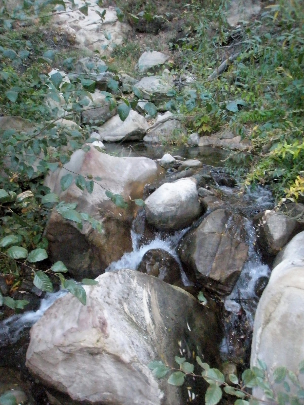
The trail was pretty nice. Several times we heard, then saw the S&R helicopter fly over us. We had to cross the creek many times, but those of us who tried were able to keep our feet dry. However, once we got to the Devil's Gateway dry feet were no longer an option.
Getting through the Devil's Gateway
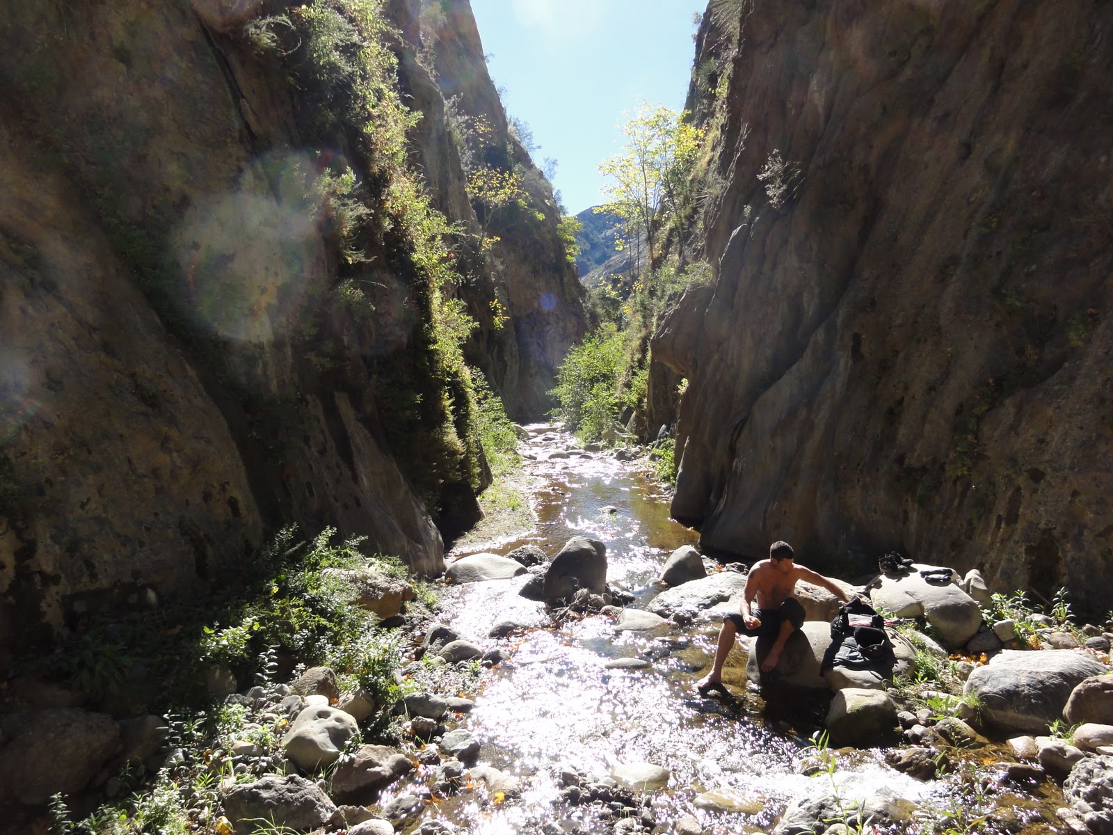
For as dramatic as The Devil's Gateway sounds it's just a short narrow section of the creek. Compared to The Big Narrows, Devil's Gateway isn't that impressive. DG's walls go up maybe 150ft to 200ft at most, and the narrow section is about 25 yards long. The Big Narrows walls go up like 500ft at least, and its narrow section goes on, and on for maybe a mile or more. A little bit past the Gateway the trail split.
You can go this way...
...Or you can go that way.
To the south the Potholes Trail, and the Agua Blanca trail continued westward. Frank, and I split from the rest of the group to go see Log Cabin Camp. It was maybe five minutes from where the trail split. I was happily surprised at how big the campsite was. There were four separate sites spread out over a large tree shaded area . There were still three BBQ grill's standing. And the dysfunctional remains of four icecan stoves were littered about.
We didn't stay at the camp very long. We wanted to catch up the other guy's who were heading up the Potholes trail to start working. The Potholes trail climbs up a long hill, and follows along side a spring fed creek. We caught up with the others who had stopped on the trail for lunch. While we were eating, and trading stories we heard a voice in the trees. Perplexed we went silent, and and tried to pinpoint the direction the voice was coming from. Then we saw the unmistakable orange shirt of a S&R team member, then another shirt, and another. There were probably 15-20 orange shirts coming down a game trail about 100ft from us. I guess the helicopter was ferrying the S&R guys out to the Potholes, and then they were hiking back.
After we finished our lunches it was time to get to work. Clipping, sawing, and raking we made our way up the trail. At the top of the there was a old cabin. It belonged to the same family that owns the Kester Camp property.
Inside the cabin there was an old stove and metal bed frame. There was some old farming equipment scattered around outside. Behind the cabin was a swamp.
This bed frame looks a lot like the bed frames at Ant Camp
The Swamp
If we had continued up the trail a little further we would have come to the Devil's Potrero. But we stopped at the cabin. We kept working on the trail for another hour or so. Fallen trees were sawed, and removed, water drainage channels were dug into the trail, and lot of plant clipping was done. Then it was time to pack up our tools, and head back.
The walk back was pleasant enough. When we got back to the Kester Camp we saw that some people had driven up, and were enjoying themselves at their ranch house. As we passed by a very friendly lady came out, and thanked us for working on the trail. She kindly offered to make us some coffee, but we declined. We talked to her for a little bit. She told us about some the history of her family's property. According to the stories she had heard, a great, great grand-father had won the property in a poker game long, long ago. She seemed like a really nice person. From there it was just a short walk back to the 4x4's. And then we drove back out. Despite getting down, and dirty out there I came out with zero poison oak, though Frank did get some on his forearms. I'd like to thank Alan Coles for organizing, and leading the trip. I also thank the other guy's that came out on the trip, and worked hard so that others can have a more pleasant time in the backcountry.
Showing posts with label The Big Narrows. Show all posts
Thursday, February 17, 2011
Monday, November 15, 2010
11-12-2010 Agua Blanca Creek
Cobblestone Mountain Foothils
One of the more impressive geological features of the Southern Los Padres rivers are the narrows. It happens when a river that normally meanders through rolling hills cuts through a rock formation, creating a narrow slot. Some examples I know would be the Sespe Narrows below Devils Heart Peak, and again further south at Devil's Gate. There's also The Alder Creek Narrows, and Piedra Blanca Creek has a narrows section. Agua Blanca Creek has two narrows sections, The Devil's Gateway, and The Big Narrows.
Dave Stillman contacted me recently to see if I was interested in checking out The Big Narrows. I knew it would a tough, probably nasty hike. So I signed up, and recruited Frank to come too.
We decided to make it a three day trip. Friday morning we hiked from Dough Flat to Ant Camp. Ant Camp sits at the base of Cobblestone Mountain where Agua Blanca Creek turns east towards Piru. It only took about three hours to make the trek. The trail is great condition. Someone, maybe the CCC, has recently trimmed, and flagged the trail going down the big hill that leads to Ant Camp. I tip my hat to whomever did that hard work, thanks. Once down at Ant Camp we set up our stuff, collected water, and gathered wood in anticipation of some cold nights.
Ant Camp
We also set up the horseshoe stakes to standard distance. Now you can enjoy a nice game of horseshoes next time you go down there. It was a pretty brisk evening, but the fire was large, and kept us warm until we ready for bed.
Trying to stay warm
The next morning we woke up a prepared for the difficult challenge we were expecting. We started heading east along side the creek at about 8:20. The trail isn't too bad for the first mile or so. We saw a few spots that would make fairly descent campsites in a pinch. There used to be a campsite called Tin Can Cabin down here. We made a good effort to find some sort of trace of it, but I'm afraid that all signs of it are completely gone now.
Looking for Tin Can Cabin
The trail got steadily worse the further we went. The poison oak was ubiquitous as expected. There were also those nasty, thorny vines everywhere too. Tons of fallen trees blocked the way. Sometimes the only way through was to slog through the creek.
After about three hours from the start the canyon started to zig-zag, and really narrow, aggressively. Finally we got to a point where you could no longer skirt the edge of the creek, we were entering The Big Narrows.
An ominous looking rock formation
Entering The Big Narrows
The walls squeezed to about ten to twenty feet wide, and rose 500 to 600 feet high. Frank and I removed our boots, and put on the water shoes we had brought with us. The water was 49.5 Fahrenheit. I wore heavy wool socks with my shoes, but my feet were still freezing. Frank had better luck with neoprene. The creek turned north then sharply came around a corner and headed south. We stopped in that section and had lunch.
If we had decided to continue I think we would have made it to Cove Camp in maybe another hour, who knows? But, we decided that we had gone far enough. We had been hiking for about four hours. I figured that since we had been going down stream it would probably take us longer to get back to camp. But I was wrong. We bulldozed back to camp in only three hours. We gathered a little bit more wood for the evening. Then we focused on dinner. We traded some stories around the fire, and then headed to bed.
The next morning we gathered up our stuff, cleaned up the camp a bit. The last people there had left behind some trash like tin foil, bottle wrappers, and batteries. The hike up the hill wasn't to bad. I found some more batteries on the way up. What's up with that? It's like someone was going up the hill, found it to difficult, and decided to ditch four AAA batteries to shed weight, pathetic. Anyway, it was an easy hike out. There were some locals shooting up the parking lot when we got back. Not much you can do except leave. You can check out some shaky videos from the trip here, here, and here.
So if you like being cold, dirty, hungry, tired, stinky, sore, getting bug bites, itchy rashes, lacerated arms and legs, wet feet, filthy hands, and chapped lips then this is a hike you may enjoy.
If you have ever done this hike, or made it all the way to Piru, I would love to hear about it. Feel free to leave a comment, or send me an email. Take care.
One of the more impressive geological features of the Southern Los Padres rivers are the narrows. It happens when a river that normally meanders through rolling hills cuts through a rock formation, creating a narrow slot. Some examples I know would be the Sespe Narrows below Devils Heart Peak, and again further south at Devil's Gate. There's also The Alder Creek Narrows, and Piedra Blanca Creek has a narrows section. Agua Blanca Creek has two narrows sections, The Devil's Gateway, and The Big Narrows.
Dave Stillman contacted me recently to see if I was interested in checking out The Big Narrows. I knew it would a tough, probably nasty hike. So I signed up, and recruited Frank to come too.
We decided to make it a three day trip. Friday morning we hiked from Dough Flat to Ant Camp. Ant Camp sits at the base of Cobblestone Mountain where Agua Blanca Creek turns east towards Piru. It only took about three hours to make the trek. The trail is great condition. Someone, maybe the CCC, has recently trimmed, and flagged the trail going down the big hill that leads to Ant Camp. I tip my hat to whomever did that hard work, thanks. Once down at Ant Camp we set up our stuff, collected water, and gathered wood in anticipation of some cold nights.
Ant Camp
We also set up the horseshoe stakes to standard distance. Now you can enjoy a nice game of horseshoes next time you go down there. It was a pretty brisk evening, but the fire was large, and kept us warm until we ready for bed.
Trying to stay warm
The next morning we woke up a prepared for the difficult challenge we were expecting. We started heading east along side the creek at about 8:20. The trail isn't too bad for the first mile or so. We saw a few spots that would make fairly descent campsites in a pinch. There used to be a campsite called Tin Can Cabin down here. We made a good effort to find some sort of trace of it, but I'm afraid that all signs of it are completely gone now.
Looking for Tin Can Cabin
The trail got steadily worse the further we went. The poison oak was ubiquitous as expected. There were also those nasty, thorny vines everywhere too. Tons of fallen trees blocked the way. Sometimes the only way through was to slog through the creek.
After about three hours from the start the canyon started to zig-zag, and really narrow, aggressively. Finally we got to a point where you could no longer skirt the edge of the creek, we were entering The Big Narrows.
An ominous looking rock formation
Entering The Big Narrows
The walls squeezed to about ten to twenty feet wide, and rose 500 to 600 feet high. Frank and I removed our boots, and put on the water shoes we had brought with us. The water was 49.5 Fahrenheit. I wore heavy wool socks with my shoes, but my feet were still freezing. Frank had better luck with neoprene. The creek turned north then sharply came around a corner and headed south. We stopped in that section and had lunch.
If we had decided to continue I think we would have made it to Cove Camp in maybe another hour, who knows? But, we decided that we had gone far enough. We had been hiking for about four hours. I figured that since we had been going down stream it would probably take us longer to get back to camp. But I was wrong. We bulldozed back to camp in only three hours. We gathered a little bit more wood for the evening. Then we focused on dinner. We traded some stories around the fire, and then headed to bed.
The next morning we gathered up our stuff, cleaned up the camp a bit. The last people there had left behind some trash like tin foil, bottle wrappers, and batteries. The hike up the hill wasn't to bad. I found some more batteries on the way up. What's up with that? It's like someone was going up the hill, found it to difficult, and decided to ditch four AAA batteries to shed weight, pathetic. Anyway, it was an easy hike out. There were some locals shooting up the parking lot when we got back. Not much you can do except leave. You can check out some shaky videos from the trip here, here, and here.
So if you like being cold, dirty, hungry, tired, stinky, sore, getting bug bites, itchy rashes, lacerated arms and legs, wet feet, filthy hands, and chapped lips then this is a hike you may enjoy.
If you have ever done this hike, or made it all the way to Piru, I would love to hear about it. Feel free to leave a comment, or send me an email. Take care.
Labels:
Agua Blanca,
Ant Camp,
Cove Camp,
Dough Flat,
Hollister Camp,
The Big Narrows,
Tin Can Cabin
Subscribe to:
Posts (Atom)