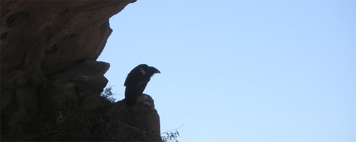
Tuesday, April 27, 2010

04-24-2010 Sespe via Tar Creek


We decided to do the Tar Creek loop this weekend. It's a long, grinding trek with a lot of bouldering. We had done it once before, but in the opposite direction as this hike. We will be hiking the Sespe in a few weeks, and we thought it would be a good idea to check out the last campsite we'll be staying at. So we went down Tar Creek to the big falls at the bottom.


The big falls


Now there are few things I have to say about rappelling off the falls. First off there is no real need to rappel off the falls. There is a trail on the north side of the falls that will take you down to the bottom. Well, most of the way down, then you have to a little bit of scrambling. It may not be as exciting, but it's a million times safer then a rappel. There are some bolt anchors set into the edge of the big falls. Someone had left their nylon webbing behind. I guess they've worked so far, but I don't know why anybody would trust those rusty ass anchors. It looks like the glue-in bolt is okay, though its sister bolt seems to have disappeared somehow. If you just have to rappel down falls there are some fine natural anchors near the edge. But here's the deal, you have to pull your anchors before you leave. That means either bring a pull rope, and retrieve your webbing from the bottom, or leave a person up top that will remove the webbing for you. This is a Condor sanctuary and these falls have Condors bathing and drinking from them all the time. Condors are curious animals and can get wrapped up in old webbing or rope and die. It really saddened me to find out we had lost a Condor last year do to someone carelessly leaving some rope behind at the falls. Don't leave anything behind at Tar Creek, be it trash, food, or rope. These guys did it the right way. Follow their example.

So after I removed the offending webbing we made use of the before mentioned trail to make our way to the bottom. At the bottom the trail disappears and you have to make your way to the Sespe by climbing down a maze of gigantic boulders.


Making our way down to the Sespe


Somewhere between the big falls and the Sespe

Once down to the Sespe it's a short upcreek walk to the campsite. Unfortunately at this time of year the creek is still high enough that we had to cross twice to get to the campsite. And there's not much to it. It's just a flat sandy area framed by some rocks. There is a grill to cook on, but that's about it. Just a few steps upcreek of the campsite there is a cave formed by a colossal boulder that has fallen on two smaller boulders. There's room inside the cave for a few people to sit around a firepit.


The entrance to the cave. Bear Heaven in the background


This is also where the long trail from Tar Creek ends/starts. We managed to walk right past the trailhead, and then spent the next hour trying to find it a few hundred yards upstream. It was a relief to finally find the son of a bitch. Have you ever been to one of those carwashes where the brushes come in from the side and scrub the side of your car? Well this trail is like that, only replace the brushes with poison oak. Along the trail we ran into a couple coming the other way. They said they were trying to get to the Sespe Hotsprings. They said that they couldn't find a map, and were, "just winging it". We told them that it would be impossible to get the hotsprings. I didn't give them any shit about how stupid they were being by going out somewhere without a map or even a clue about where they were. I think they thought they were at Dough Flat. It took us about three hours to make it back to the Tar Creek trailhead from the Sespe.

Monday, April 19, 2010

04-17-2010 Sierra Madre Ridge


Cherry Orchard Spring


I think the first thing I should say about this trip is that it would not have been possible without Tom and Kim from Habitatwork.com . They do great work organizing volunteers for highly worthy restoration projects in the southern California national forests. Our mission this weekend was to remove a infestation of knapweed that was growing along a section of Sierra Madre Ridge Road. We were able to accomplish this goal with a little hard work from bunch of cool people.

To get there it's a long drive up the 33 toward Cuyama, then a winding, dusty, 26 mile drive into the Los Padres backcountry. We camped at what the Forrest Service calls Painted Cave Campground. According to historians the Chumash called the spot S'ap'aksi. The Forest Service isn't keeping this site a secret, so I'll tell you about it. The topo map even marks the site with, "Petroglyphs" which to me seems kind of counter to the normal Forest Service policy of secrecy regarding culturally significant sites. Also "petroglyphs" seems like the wrong term. A petroglyph is a carving in stone. I guess they might be referring to the mortar holes that dot the rocks. But that's sort of like saying the Louvre has a lot of nice picture frames. Pictograph, the more appropriate word to me, is a painting on rock, but I digress.

This site has horse corral and outhouse and lot of space for camping. The terrain is hilly and slopes downward towards Leap Canyon and eventually the Sisquac River several miles to the south. How would you get here without a car and key to the gate 13 miles from the campsite? You could take the Sweetwater Trail up from the San Raphael Wilderness. The Jackson Trail from Sycamore Camp is another option coming out of the San Raf, more on that trail later. There is another trail that I think is called The Rocky Ridge Trail (the topos don't seem to name it, and I can't remember what the sign said) that goes out of the camp toward Newsome Canyon and Cuyama.

There is a rock formation with Chumash paintings before you get to the FS gate. I'm not going to tell you where it is though. It's very close to road and I'm surprised it's survived this long.


Once past the gate it's a long drive to Montgomery Potrero. I would guess that any large rock formation near a spring has a lot of potential for rock art. You just have to be willing to sweat a lot and take a few risks. A few miles up the road from S'ap'aksi is the Pine Corral. This is a big grassy area used for cattle grazing with rock formations popping out all over the place. If you decide to look for rock art here watch out for the big black bull that lives there with his harem of cows, he can be down right ornery. And while I'm at it when I was down in one of the side creeks looking rock art I came face to face with a rattlesnake. No big deal, it happens all the time. But this one was really not happy to see me. I found out later that it was because Frank had passed by it earlier and picked it up with a stick, thoroughly pissing it off.


An angry rattlesnake

Just past the Pine Corral is Lion Canyon. This canyon is an absolute jaw dropper. It used to be a California Condor release site. There are so many nooks and caves in Lion Canyon I could spend a week there wandering around taking it all in.


Lion Canyon

Then you arrive at S'ap'aksi. At the ground level right next to a trickling waterfall is a painting that I interpret as a dolphin. This is one the largest Chumash paintings I have personally seen. It's been badly damaged, but the head, dorsal, and front fins are still visible. If you go up and behind the rock you can find the little spring that feeds the waterfall. Follow that spring down at will lead you right to "The House of the Sun". Inside the cave you will see a large sunburst painting and few human/ animal like figures. There's a paper online by Georgia Lee and Stephen Horne that gives a lot info about S'ap'aksi, most of it (like all Chumash information) was gathered by Harrington. Like all academic work on the Chumash, I would take it with a grain of salt. I don't think that true full blooded Chumash shared there secrets with non-Chumash. Of course, I'm basing my opinion on information gathered by Harrington, so take that with a grain of salt as well. You can check out a video I took at the site here

If you keep heading up the road another half mile you find a sign that says, "Jackson Trail." Follow that trail another half mile and you come upon a dilapidated cabin. It doesn't look like an old time "historical" cabin but more like a shitty cowboy shack. I took a short video of the place. There is a creek with water right behind the cabin. But that's it, the trail does not continue on to the San Raf from here. Looking at the topo map (Hurricane Deck) the Jackson Trail is the road (Sierra Madre Ridge Road) and the cabin is just a little side trek. I can see how the sign there would be confusing to a hiker. Here's a video.


This cabin looks like it still gets some use


Thanks to a academic newsletter published by a Rock Art Group that is advocating closing off cattle grazing access to about half dozen sites on the Sierra Madre Ridge, I was able to figure out where some of those rock art sites were.


A chipped figure

So thanks again to everyone involved with Habitatwork.org . I had a great time, and really appreciate the opportunity go out and search for these paintings.


This gopher snake owes its life to Tom

Wednesday, April 7, 2010

04-03-2010 Middle Sespe Rocks


I wasn't really planning on doing any hiking this weekend, until Friday evening when Megan asked if I wanted to go anywhere for my birthday. For a long time now I've been curious about the large rock formation that you can see in the distance behind the Middle Sespe trailhead. These formations look a lot like the Piedra Blanca formations that lie a few miles downstream. I've wanted to get back there and look for caves and archeological artifacts. Megan, Mike and I started from the mentioned Middle Sespe trailhead right off the 33. Instead of staying on the trail when it first crosses the Sespe we made our way upstream for little bit before we found a small creek that was flowing from the Northeast. We followed the winding little creek up about half a mile where came to some cool look rocks that were framing the creek. These rocks had some cool caves and depressions in them. A little further on and the terrain open up into a flat plain, that rock formation was further away then it looked from the road. We continued on up the creek until we came to a rocky squeeze. This was supposed to be a easy hike and I didn't want to elevate to a full on exploration mission. At this point the fog was rolling over Ortega hill and falling towards us. We decided that we had a nice time outside but that it was time to head back. We stopped at the Red Barn for some tacos before we went home. Thanks Megan, that was a nice birthday gift.

Tuesday, March 23, 2010

03-20-2010 Stone Corral Creek


Maybe you've been thinking, "These are nice hikes, but where's the canyoneering?" Well, we aimed to correct that situation this weekend. There are a few great hikes that originate at Dough Flat. You can go to Ant camp on Agua Blanca Creek like we did a few weeks ago. Or you can take the trail to Alder Creek and Shady Camp. You can also go down Alder Creek and take the Sespe back to Tar Creek or Devil's Gate. Or you can make your way over to the Sespe Hot Springs from Shady Camp. We decided that these were not for us. The plan we came up with was to hike to Cow Spring Camp, about 3 miles from the trailhead, Friday, and set up a base camp. The next morning we would pack up our canyoning gear and head down Stone Corral Creek. Stone Corral Creek (SCC) flows through the Stone Corral, a rocky sloping decline, and meets up with the Sespe right where it turns south, at the base of Topatopa Mountain, and flows through what's known as the Sespe Narrows. The only information I've been able to find about it is a short mention from the, "Tenth Annual Report of The State Mineralogist For The Year Ending December 1, 1890."

Despite having 50lb packs the hike to Cow Spring wasn't anything to complain about. Somewhere near Squaw Flat I saw a couple of Condors fly over Hopper Mountain and then come and circle us for a few minutes before heading West. We set up camp and had nice dinner of Camp Pizza and tri-tip with a couple delicious homebrews that we had chilled in the creek. The next morning (Saturday) we ate some bacon, and bread, and then gathered up our rope. The first part of the Stone Corral is a slight downward slope. From Cow Spring to the Sespe is a total decent of 1500ft. We stayed above the creek on ridges for the most part.


The Stone Corral

If not for a fire a few years back I think this whole area would be impassably choked by sagebrush and Mansanita. About 1/3 of the way down we came to the first waterfall. It was about 15ft high. This is where the terrain started to take a steeper gradient.


Stone Corral Creek winding towards Topatopa Mountain

We walked up an over a rocky ridge to the right (north) of the creek. We couldn't find any signs that people had been down here at all, no can tabs, glass, nothing. At about the 2/3's mark we found another 15ft waterfall with a deep muddy cave.


Waterfall with cave


It was little bit past this that we found a rusty fence post with some rusty barbed wire sticking out of the ground. I was dumbfounded by this. I can't figure out how someone would have been able to plant a fence back here. I guess the name "Stone Corral" sort of implies that this was used to hold livestock at some point in time. But that was up by Cow Spring. Honestly I have no idea how one would get a horse or livestock down that far and back. After the fence post the gradient got steeper again, and we had to go the rest of the way through the creek. Two short rappels we required right at the end of the creek, and we were through the Stone Corral Creek.

It was about 3 o'clock, and I was tired. We had made it to the Sespe, but it had taken 2.5 hours longer then I had hoped it would take. We stopped and took 15 minutes for lunch. The Sespe was really flowing swiftly, but we had to cross it twice to get to the Alder Creek confluence a mile and half upcreek. I looked at watch and thought, "We have three hours to make a four hour hike." and resigned to to the idea that we would be doing some night hiking. At this point I was to exhausted to take any more pictures or video. Every minute not hiking was going to be another minute in the dark, I just wanted to get the heck out of there. So up Alder Creek we slogged. When the Alder Creek Narrows finally rose up in front of us my heart almost broke. However it was just intimidating and not impossible to climb up and over. A little bit upcreek and we found Shady Camp. It has a Forest Service grill and someone had left a iron pole for breaking up concrete, and a small bottle of Jack Daniels.


Shady Camp


We were able to find a faint trail leading out of Shady Camp that after about half an hour brought us to a small grassy camp with a Forest Service grill. A few hundred yard upcreek we found Alder Creek Camp. There was a FS grill, and a broken FS smoker thing.


Alder Creek Camp

It wasn't much further when the trail started to ascend, and we knew we were close to the switchbacks. Half an hour later we made it to Drippings Springs just as the sun was starting dip below the mountains. When we got to the top of the switchbacks it was dark and I broke out my headlamp. It was about another mile before we could make out the reflections from our tents in the distance. Both of us were far to tired to make anything to eat so we changed clothes, and went to our tents to pass out, whew!

The next morning we dried out our cold, wet boots. Then we packed up our bags and headed back to Dough Flat. It had been over 40 hours since we had seen another human. We were looking forward to hot showers and hot food.

If you know anything about SCC please contact me or leave a comment.

Monday, March 22, 2010

03-13-2010 Piedra Blanca

Piedra Blanca is always a nice place to go for a short day hike. You can climb the rocks or go searching for hidden caves.


Frank, Heidi and I decided we would hike to Piedra Blanca Camp and take a look at the Chumash Rock art that is along the trail. It's no secret that there's Chumash pictography here. The Forest Service has a big display at he trailhead that shows one of the paintings in it's former glory. I won't say specifically where this site is, but it's not that hard to find. We started the hike by wading across the Sespe.


It's a short 30 minute hike to the Piedra Blanca rock formations. We spent a little time there wandering around. Then we headed up the Gene Marshall-Piedra Blanca National Recreation Trail. According to what I could find Gene Marshall was,"... a leading advocate of wilderness designation for the Sespe who played a key role in the development of the Los Padres Condor Range and River Protection Act." The trail itself is pleasant enough. It meanders alongside Piedra Blanca Creek for a couple of easy miles until you hit Piedra Blanca Camp. This is a pretty nice camp. It has plenty of spots for tents. There are a couple of fire pits. And there are a few big old Oak trees to provide ample shade and places to hang your pack. A few minutes further upcreek and you come to Twin Forks camp. This looks like a nice camp as well. There were some people camping there, so I just took a quick look, but didn't snap any pictures. The hike back to the trailhead was easy-breezy. So somewhere along this trail there is a boulder with some badly damaged Chumash Rock paintings. They look like very typical Chumash pictographs. There's a bird-like figure that I interpret as a Condor. There's a human type figure drawn with the distinct bend in the arms and legs that seems so common with Chumash art.


All in all it was a nice little day-hike. How about next week we try something a little more challenging?

Photos: Frank Jones

Monday, February 22, 2010

02-20-2010 Agua Blanca Creek

This week we wanted to get out and see something new. If you look at the Dough Flat area on the topographic map from the USGS (Devil's Heart Peak Quad) there have a bunch of waterfalls listed. We decided that with the recent rains that this would be a good time to go and look for some of those waterfalls. We found out that the drive from the bottom of Goodenough Road to the Dough Flat trailhead is about half an hour long (just thirteen to the Tar Creek trailhead). There was a nice fifteen foot waterfall just before we got to Dough Flat.


It had been raining just a few hours before we arrived, but the ground wasn't unreasonably muddy. There is a little makeshift creekside camp just before Squaw Flat. We went off the main trail and followed a hunters trail east toward some of those waterfalls. The falls weren't that notable, but while we back there we found a toppled over oil drilling rig that has been long abandoned.


One thing I learned after this hike is that the term "squaw" is considered by some native american groups to be derogitory:

http://tinyurl.com/yjlkcln

After that diversion we got back on the main trail and made our way towards Bucksnort Spring. This is a pretty cool little spot. There is a small fire pit that had not been used in ages. And Bucksnort was flowing. We took a little time to try and get to the springhead but gave up after a few minutes.


We then started towards our next destination, Ant Camp. Ant Camp is located right where Agua Blanca Creek starts turning east toward Lake Piru and about six miles from the Dough Flat trailhead. The hike there from Bucksnort is pretty straightforward. It's just when the trail starts to descend towards Agua Blanca you realize that it's going be long hike back up.


Ant Camp was a pleasant surprise. It's nestled underneath an big old oak tree in a large valley with other smaller oaks. There's fire pit, picnic table, bbq grill, a couple of ancient bed frames, and even some horse-shoes and pins should you feel like playing a game.


While we sitting there catching our breath a bi-plane came racing up the creek from the east, looped around us a few hundred feet up and then went racing back down towards Piru. It was about 11:30 at this point and our last goal (besides getting out in one piece) was to find Saddle Skirt camp. According to the map it's supposed to be about a mile up Agua Blanca Creek from Ant Camp. The first thing I noticed about Agua Blanca is that the rocks start to change from sandstone to granite. Granite is much slicker then sandstone when it's wet so you really have to watch you footing. There are bits of trail going up-creek, but for the most part it's very much overgrown. As for Saddle Skirt camp, well we couldn't find it. When we got to the spot where it was shown the map there was nothing but a weird hole in the ground. We went searching even further up-creek to where Franks GPS indicated the camp was, but had no luck there either. It was 1:00pm at that point, which meant it was time to turn around a head back to the Jeep. We stopped briefly at Ant camp one more time to refill our water bottles and change our socks then we marched up and out of there. Four hours later we were back at the trailhead. The hike was about thirteen miles round trip.

One after thought here, if you are thinking about doing this hike I would suggest trekking poles. I forgot mine and really wish I had brought them. Take care.

Monday, February 15, 2010

02-13-2010 Tar Creek

Tar Creek is a hike we have done many times before. However, each time you go you can't help but be impressed by it's scale and power. This hike was no different. With the recent heavy rains we knew Tar Creek would be really flowing. An oil spill had closed the road to the trail-head for a couple weeks, but the gate was now opened for all. We were happy have to along Franks' childhood friend Erin for the days adventure. Once we got down the first hill we could that the creek was moving a lot of water. The cascades were pretty much overwhelmed by rushing water.


Our normal route was flooded so we had to take a slightly more risky way around the bottom pool of the cascades.


We made to the bottom falls without to much trouble, but just having all that water raging right next to you can make second guess yourself in places you normally wouldn't. The final falls were going off to a degree I have not witnessed before.


If you look closely you can see Erin standing at the top of the falls.


Speaking of degrees, I took a reading with my digital thermometer and the water temperature was a cool 45 degrees. We had lunch, took a lot of pictures. We didn't see any condors this time. Some jerk left his beer can behind. It really angers me to find trash down there. The condors have a thing about eating shiny things. Any trash like candy wrappers or aluminum can tabs or even coins and glass can end up be eating by a condor and as a result kill them. Leaving your trash behind is an asshole move anywhere. Leaving your trash behind in the Condor Sanctuary is completely unacceptable to me. The hike up and out was pretty standard. All in all it was a great hike that I think all three of us enjoyed quite a bit.