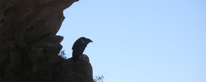
The Stone Corral and Topatopa Peak
I haven't been camping in a long time. I also haven't been on a really long hike in awhile. The weather has been good, so I thought it was high time to get out for an overnighter. Frank, Zach, Cara, and I decided to start out at my favorite trailhead, Dough Flat, and then make our way up to Alder Creek. The day before we left I called the Forest Service and asked them if the road was open all the way to the trailhead. They told me, no, it's closed at Tar Creek (a few miles from the TH) because of a three foot deep mud puddle in the road. Well that was too bad but it wasn't going to stop us. Actually I didn't tell anybody about the gate until we got to it. The closed road was dry, bone dry, of course (thanks a lot Forest Service).
Hopper Mountain
It took about an hour and a half to get to the Dough Flat TH. Half an hour later and we were at the Squaw Spring guerrilla camp. Another two hours and we were at the Bucksnort junction. Soon we passed Cow Spring and the Stone Corral.
The Stone Corral
The trail then descends down a large hill. About half way down the hill is Dripping Spring. This also marks the beginning of the poison oak. We ate lunch and refilled our bottles. Then we made our way down the rest of the hill. At the confluence of the Alder Creek East Fork and a no-name creek the trail becomes much, much harder to follow. Frank and I had been up this trail before, a few years ago, so we kinda knew where to go. Still finding the trail was difficult. Up and down hills, through dried up creek beds, across mesas, then up a poison oak lined creek.
Looking south over Alder Creek
Finally after eight hours of hiking we saw the giant Oak that marked our campsite. We didn't really have time to rest. We had to get our tents set up and gather some firewood before the sun went down in an hour or so. Once we got the campsite set up properly we threw a couple of Bristol Farms porterhouses on the grill and sipped Laphroaig 10 Year Old.
The morning was a bit chilly. But things warmed up once the sun was able to angle over the canyon walls. We packed up our stuff and got ready to leave this rather unremarkable campsite. Instead of going back the way we came, we opted to go down Alder Creek directly. I wore my Canyoneers and 3mm neoprene socks. North of the Sespe you will notice that rocks turn from mostly sandstone to a mix of sandstone and granite. The granite can be quite slippery when wet. My shoes preformed well beyond my expectations. Even with water flowing over the granite my shoes stuck to the rocks. Even with sound footing, all that rocking hopping with a heavy backpack can take a toll on your knees.
Alder Creek
The creek was pretty nice. The water was about knee deep in most spots. It did get up to my waist in one section. There was only one spot where we had to take off our packs, down climb some slick logs, and then lower the packs.
I think it took about two hours to get to the East Fork / Alder confluence. Then it was just a few minutes before we found Alder Creek Camp. Not much there but a fire ring and an old icecan stove.
Alder Creek Icecan Stove
Alder Creek II
There's another small camp a few hundred yards downstream. I don't know if this was an overflow camp at some time, or if somebody just dragged a grill down there from the proper Alder Creek Camp. Not to much further down the creek we found Shady Camp and set our packs down for the day. There was still enough light out to wash some clothes and get a quick bath in the creek. Refreshed we settled down for our second night.
Frank and Zach at Shady Camp. Frank is holding a rock breaker bar that was left at the camp
Looking south down the Alder Creek Narrows. It was a humbling view
The next morning we took our time packing up. The trail back crosses the creek several times. A some points the trail is the creek itself. We were able to keep our boots on and dry all the way back to Dripping Spring Hill.
One has to wonder, did the Day Fire stop right here?
Dripping Spring is a real life saver. Right now it's more than dripping, it's really gushing. The spring turns into a flowing creek that links up with the other creeks downhill. The slog up the hill wasn't too bad. Once we got over the peak of the hill it was a rather pleasant hike back to Squaw Spring Camp. There we made camp for the last night of this trip. The next morning we packed up one last time then headed out to Dough Flat and then the dry dirt road to Tar Creek.
Relaxing at Squaw Spring Camp
Dough Flat Waterfall
Okay, so somewhere along this hike there is a cave. Perhaps it was off in a narrow canyon, or down an old dusty trail, or maybe up a dry creek bed, I'm not saying. In this cave are Chumash pictographs. It's mostly zoomorphic figures, with some geometric shapes scattered about as well. Some are trichrome others are monochrome. In my amateur opinion I'd say that there were several different artists contributing to this cave. Of all the Chumash caves I've been to, this one is my favorite.
As always, I encourage you to leave a comment, or ask any questions you have.
Tuesday, May 10, 2011
Monday, May 9, 2011
04-16-2011 Sespe River
Frank has wanted to do the Piedra Blanca Trailhead to Red Reef Trail for a few years now. Finally all the pieces came together and he and Heidi were all set for a four day hike this weekend. Due to my work schedule I wasn't going to be able to join them for this trek. But I decided that I could at least hike out along the Sespe Trail with them until they had to turn up the trail towards Santa Paula. We ate a tasty breakfast at Eggs & Things in Ojai. Then we headed up the 33 to the PB trailhead.
It was 9:00 and the parking lot was full of cars. The horse trailer from Thacher School was there as I've seen it so many times before. There are two creek crossing right at the start of the Sespe trail. Most of the year you can rock hop across the creek and keep your feet dry. The water was flowing too high this day and we had to wade across the creek. About ten minutes down the trail you have to cross Piedra Blanca Creek. It too was flowing too high for rock hopping. After that it's a sorta boring hike out to Bear Camp. At the Bear Camp crossing the water was waist deep. I opted to take off my pants and wade across in my skivvies.
Okay, so three years ago Frank and I tried to hike from Tar Creek to Grassy Flat. I remember it being a super hot day. We started early and didn't see anyone. It was an exhausting hike. As we were getting close to the West Fork we noticed some smoke coming up from behind a couple of rocks. We walked over and saw two men and a pitbull sitting next to a fire. The old man holding the pitbull was wearing sandles that had been made out old tire tred and some rope. I remember thinking, "How the hell did this guy get out here in those sandles?" We weren't sure what to make of these guys so we just waved and moved on.
So then last year when we did our Tar Creek loop we lost the trail back up when we got to the Sespe Camp. After we had spent an hour searching for the start of the Green Cabins road we ran into three people who were down there to do some fishing. We asked them about the trail but they didn't seem to know what we were talking about. Then it struck me, "Hey, didn't I run into you last year down here?" Yup, it was the same guy we had seen with the old man the previous year. I thought it was a funny coincidence. He offered us some Tequila, but we had to find the trail.
So back to the present. After we had crossed the Sespe at Bear Camp these three people come strolling down the trail. We exchanged greetings. Then it struck me again, "Hey, aren't you the guy we keep running into on the Sespe?" Yup, third year now that we've run into this guy. I had to laugh. I've got a feeling I'm going to cross paths with him again next year.
The Bear Camp Crossing
We dried our feet and put our boots back on. Then we started to make our way towards Kerr Spring. When we got to the spring I decided that I would make that my turnaround spot. Like 75% of my coworkers I've been sick the last few weeks. I've been getting better, but I'm still not fully healed. I just didn't feel like pushing myself any further. So I bid farewell to Frank and Heidi and then headed back towards the trailhead. I must have passed at least a dozen people headed up towards Willett on my way out.
If Frank feels like writing up a report I'll put it here. Here's some pictures from his trip.
The Harris Tunnel
California Conservation Corps working the trail
Monday, April 4, 2011
04-02-2011 The Playground and Lizards Mouth
Overlooking a foggy Santa Barbara
Well, we knew we wanted to get out this weekend. We just didn't know where to go. We had already hit up Ventura's big three, Tar Creek, Matilija, and Santa Paula Canyon, in our last three hikes. So I tried to think of somewhere cool to visit. What I came up with was a trip to Santa Barbara's Santa Ynez Mountains. So we drove up the San Marcos Pass to West Camino Cielo Road. The marine layer was thick up on the pass this day. As we drove higher up the mountain we temporarily got above the fog. I had read about an area called The Playground that was supposed to be real popular with local boulderers. When we got to the unmarked trailhead, right across the street from a sign that says, "Tanbark Oak", I was little surprised that we were the only ones parked there. The sun had been up for a few hours, I had thought there would be other folks up there before us. The trail led us down the ocean side of the mountain. The fog made it hard to judge how far we went down.
There were lot's of big rocks to climb, and explore. I think we hiked down for at least a hour, maybe two. The fog rolled in some more, and our visibility was reduced to about fifty feet.
We took a snack break, then headed back up the mountain. I guess Santa Barbara woke up while we were hiking, because the road was filled with parked cars when we got back to the Jeep. It was around noon, and we still had plenty of energy, so we decided to go up to Lizards Mouth, and practice some rappelling on the rocks up there.
I think we spent a hour or so going over rigging and reviewing some techniques. I practiced rappelling past a knot in the rope. The wind picked up, and we decided to call it a day. That's about it. Sorry, nothing too crazy this week.
Well, we knew we wanted to get out this weekend. We just didn't know where to go. We had already hit up Ventura's big three, Tar Creek, Matilija, and Santa Paula Canyon, in our last three hikes. So I tried to think of somewhere cool to visit. What I came up with was a trip to Santa Barbara's Santa Ynez Mountains. So we drove up the San Marcos Pass to West Camino Cielo Road. The marine layer was thick up on the pass this day. As we drove higher up the mountain we temporarily got above the fog. I had read about an area called The Playground that was supposed to be real popular with local boulderers. When we got to the unmarked trailhead, right across the street from a sign that says, "Tanbark Oak", I was little surprised that we were the only ones parked there. The sun had been up for a few hours, I had thought there would be other folks up there before us. The trail led us down the ocean side of the mountain. The fog made it hard to judge how far we went down.
There were lot's of big rocks to climb, and explore. I think we hiked down for at least a hour, maybe two. The fog rolled in some more, and our visibility was reduced to about fifty feet.
We took a snack break, then headed back up the mountain. I guess Santa Barbara woke up while we were hiking, because the road was filled with parked cars when we got back to the Jeep. It was around noon, and we still had plenty of energy, so we decided to go up to Lizards Mouth, and practice some rappelling on the rocks up there.
I think we spent a hour or so going over rigging and reviewing some techniques. I practiced rappelling past a knot in the rope. The wind picked up, and we decided to call it a day. That's about it. Sorry, nothing too crazy this week.
Monday, March 28, 2011
03-26-2011 Santa Paula Canyon
Looking down Santa Paula Canyon
It's been a while since we've been able to get out for a hike. Two weeks ago I saw the forecast for last weekends weather, and ruled out any type of hiking. The canyons are no place to be when it rains. It was quite a storm that rolled through here too. According to the USGS it was the largest rain event since the epic 2005 storms.
I figured after a storm like this one that Jackson Falls would probably be going off. So we prepared for a wet, muddy hike. Once we got past Thomas Aquinas College, the Ferndale Ranch, and the oil pumps, we could see Santa Paula Creek was angry.
That was okay, she was angry last year when we made it out to Jackson Falls. As I remembered we could make it all the way to Big Cone Camp without actually having to cross the creek. This day things were slightly different. We got about halfway to part of the trail where it starts to switchback up to Big Cone Camp, and the creek had flooded wall to wall of the canyon. We sure as hell weren't going to try to wade across this unforgiving beast. So we backtracked a bit and found a spot along the canyon wall where we could get up and above the creek. Then we bushwhacked for what seemed like a really long time. Did I mention there was more poison oak then I have ever seen? We tried a couple of times to descend back down to the creek but we just found high, sheer cliffs. Finally we found a spot that was steep, but not to steep that we couldn't control slide down. Of course we had to slide through poison oak, but what are you going to do? We flicked off some ticks that were trying catch a ride, applied some Tecnu, then started making our way up the creek again. We missed the turn to the switchbacks, so we opted to go up a steep, rocky, gully that intersected with the trail.
The price for not paying enough attention to the trail
We walked through the graffiti gallery that is Big Cone Camp then down to the first waterfall. It was really a site to behold.
Graffiti Falls
Between the waterfall and Cross camp there a few rocky outcrops that overlook the creek as it flows through a narrows section. It's here that the power of the creek is most impressively displayed. It about a hundred yards of frothy, white, fury.
Looking up the channel
We stopped at Cross Camp for a bit to get a bite to eat. Last year when we made to Jackson Falls we had to make a leap of faith. Just upcreek of Cross Camp there was a spot where we could jump from one boulder to another to cross the swollen creek. Not this day. The water level was about a foot higher then the last time we were there. There wasn't even any debate about it, there was no way we were going to try to get across this rapid creek.
The idea was to jump from the rock I'm stading on to the one on the left
Okay, so what do we do now? If you look at the USGS topo Santa Paula Peak quad there's a creek that comes down from the Bear Heaven Bluffs to the east of SP Creek, and links up with SP Creek right above peak 2507 (there's a link in the sidebar). We decided to bushwhack over to that tall waterfall.
Not surprisingly this waterfall looks a lot like Lower Jackson Falls
First we climbed up a rocky hill that overlooked the Punchbowl, then we found a game trail that took us eastwardly towards the falls. It wasn't as bad as the bushwhacking we had done earlier. As we got closer we saw a large oak tree that had a few faded beer cans strewn about its base. Then the chapperel opened up and there was a nice rocky area next to the waterfalls.
There are two waterfalls, the smaller one is hidden from view when looking up from the bottom. The stream snakes down through a smooth water carved channel to the larger falls then drops 60 to 70 feet to creek below. We hung out there for awhile. The rocks were leaching our body heat so we had get up every few minutes to keep from getting too cold. Finding the route back was little more difficult, but we figured it out.
The Santa Paula East Fork
When we got back to the spot where we had bushwhacked we were disappointed to find out that we had to go back the same way, funny how that works. Unfortunately we had to start further back because that steep part we slid down was to steep to climb back up. Remember all that poison oak we tramped through? It was still there, and I think it called in reinforcements while we were upcreek. This bushwhack seemed to take even longer then the first time. We were down on our hands and knees, and sometimes even our stomachs crawling though the bush.
Here's picture of my butt to illustrate that we had to crawl a lot
"Ridiculous" is the word that comes to my mind. Surely we had gone far enough to make it back down to the creek, nope, sheer cliff, shit, keep crawling. I did have some climbers webbing, and a single carabiner in my bag in case of an emergency, but that wouldn't be needed here. Finally we found a way down. Another scrub down with Tecnu was in order. From here it was fairly easy to walk back out. We hadn't seen another person all day. On a sad note I tore a big hole in the bottom of my favorite backpack. Despite what sounds like a horrible experience, we were in pretty good spirits. It was an adventure, and that's what we like.
It's been a while since we've been able to get out for a hike. Two weeks ago I saw the forecast for last weekends weather, and ruled out any type of hiking. The canyons are no place to be when it rains. It was quite a storm that rolled through here too. According to the USGS it was the largest rain event since the epic 2005 storms.
I figured after a storm like this one that Jackson Falls would probably be going off. So we prepared for a wet, muddy hike. Once we got past Thomas Aquinas College, the Ferndale Ranch, and the oil pumps, we could see Santa Paula Creek was angry.
That was okay, she was angry last year when we made it out to Jackson Falls. As I remembered we could make it all the way to Big Cone Camp without actually having to cross the creek. This day things were slightly different. We got about halfway to part of the trail where it starts to switchback up to Big Cone Camp, and the creek had flooded wall to wall of the canyon. We sure as hell weren't going to try to wade across this unforgiving beast. So we backtracked a bit and found a spot along the canyon wall where we could get up and above the creek. Then we bushwhacked for what seemed like a really long time. Did I mention there was more poison oak then I have ever seen? We tried a couple of times to descend back down to the creek but we just found high, sheer cliffs. Finally we found a spot that was steep, but not to steep that we couldn't control slide down. Of course we had to slide through poison oak, but what are you going to do? We flicked off some ticks that were trying catch a ride, applied some Tecnu, then started making our way up the creek again. We missed the turn to the switchbacks, so we opted to go up a steep, rocky, gully that intersected with the trail.
The price for not paying enough attention to the trail
We walked through the graffiti gallery that is Big Cone Camp then down to the first waterfall. It was really a site to behold.
Graffiti Falls
Between the waterfall and Cross camp there a few rocky outcrops that overlook the creek as it flows through a narrows section. It's here that the power of the creek is most impressively displayed. It about a hundred yards of frothy, white, fury.
Looking up the channel
We stopped at Cross Camp for a bit to get a bite to eat. Last year when we made to Jackson Falls we had to make a leap of faith. Just upcreek of Cross Camp there was a spot where we could jump from one boulder to another to cross the swollen creek. Not this day. The water level was about a foot higher then the last time we were there. There wasn't even any debate about it, there was no way we were going to try to get across this rapid creek.
The idea was to jump from the rock I'm stading on to the one on the left
Okay, so what do we do now? If you look at the USGS topo Santa Paula Peak quad there's a creek that comes down from the Bear Heaven Bluffs to the east of SP Creek, and links up with SP Creek right above peak 2507 (there's a link in the sidebar). We decided to bushwhack over to that tall waterfall.
Not surprisingly this waterfall looks a lot like Lower Jackson Falls
First we climbed up a rocky hill that overlooked the Punchbowl, then we found a game trail that took us eastwardly towards the falls. It wasn't as bad as the bushwhacking we had done earlier. As we got closer we saw a large oak tree that had a few faded beer cans strewn about its base. Then the chapperel opened up and there was a nice rocky area next to the waterfalls.
There are two waterfalls, the smaller one is hidden from view when looking up from the bottom. The stream snakes down through a smooth water carved channel to the larger falls then drops 60 to 70 feet to creek below. We hung out there for awhile. The rocks were leaching our body heat so we had get up every few minutes to keep from getting too cold. Finding the route back was little more difficult, but we figured it out.
The Santa Paula East Fork
When we got back to the spot where we had bushwhacked we were disappointed to find out that we had to go back the same way, funny how that works. Unfortunately we had to start further back because that steep part we slid down was to steep to climb back up. Remember all that poison oak we tramped through? It was still there, and I think it called in reinforcements while we were upcreek. This bushwhack seemed to take even longer then the first time. We were down on our hands and knees, and sometimes even our stomachs crawling though the bush.
Here's picture of my butt to illustrate that we had to crawl a lot
"Ridiculous" is the word that comes to my mind. Surely we had gone far enough to make it back down to the creek, nope, sheer cliff, shit, keep crawling. I did have some climbers webbing, and a single carabiner in my bag in case of an emergency, but that wouldn't be needed here. Finally we found a way down. Another scrub down with Tecnu was in order. From here it was fairly easy to walk back out. We hadn't seen another person all day. On a sad note I tore a big hole in the bottom of my favorite backpack. Despite what sounds like a horrible experience, we were in pretty good spirits. It was an adventure, and that's what we like.
Labels:
Jackson Falls,
Santa Paula Canyon,
Santa Paula Creek
Subscribe to:
Posts (Atom)


