Lake Piru
We had a cool opportunity to drive up Piru Creek this weekend. Some Condor Trail people were going to Agua Blanca Creek to do some trail work. Frank, and I decided to tag along, and help out. The nice thing about going with these folks was they had key to all the gates on Piru Canyon Rd. So we got to drive (instead of walking or biking) the four miles to the Agua Blanca trailhead. It seems like there's a gate blocking the way everywhere I want to go these days.
North of the lake
The drive up Piru Canyon was gorgeous. I'm not sure what the status of the Juan Fernandez Boat Launch is. It's obviously closed to anyone without a key to the gates. But it still looks brand new, and the Coke machine there is still getting power some how. A bit past the abandon Blue Point Campground we passed by a bunch of Search and Rescue guys doing some sort of training in the creek.
We parked at the Whitaker Ranch. We geared up with Fiskars loppers and McLeods. Right next to the Whitaker Ranch is the Kester Camp. Kester Camp is not a campsite, it's a cozy little ranch house, and property. Once you pass Kester Camp you walk through a little turnstile, and you're on the proper Agua Blanca Trail.
This sign has survived many fires.
The trail was pretty nice. Several times we heard, then saw the S&R helicopter fly over us. We had to cross the creek many times, but those of us who tried were able to keep our feet dry. However, once we got to the Devil's Gateway dry feet were no longer an option.
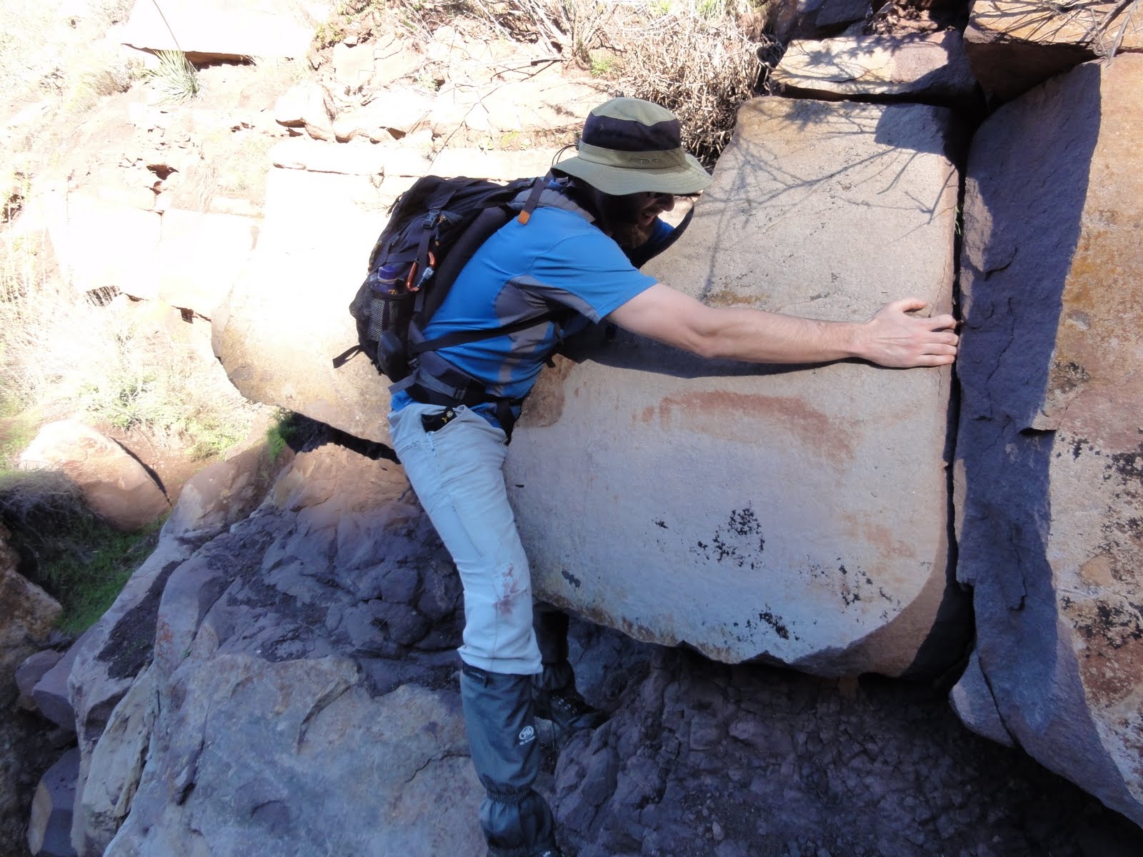
Getting through the Devil's Gateway
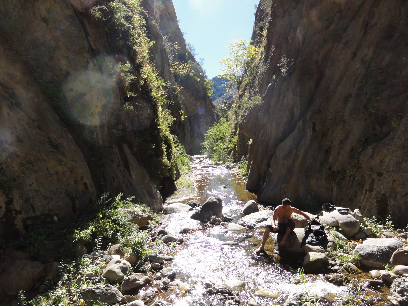
For as dramatic as The Devil's Gateway sounds it's just a short narrow section of the creek. Compared to The Big Narrows, Devil's Gateway isn't that impressive. DG's walls go up maybe 150ft to 200ft at most, and the narrow section is about 25 yards long. The Big Narrows walls go up like 500ft at least, and its narrow section goes on, and on for maybe a mile or more. A little bit past the Gateway the trail split.
You can go this way...
...Or you can go that way.
To the south the Potholes Trail, and the Agua Blanca trail continued westward. Frank, and I split from the rest of the group to go see Log Cabin Camp. It was maybe five minutes from where the trail split. I was happily surprised at how big the campsite was. There were four separate sites spread out over a large tree shaded area . There were still three BBQ grill's standing. And the dysfunctional remains of four icecan stoves were littered about.
We didn't stay at the camp very long. We wanted to catch up the other guy's who were heading up the Potholes trail to start working. The Potholes trail climbs up a long hill, and follows along side a spring fed creek. We caught up with the others who had stopped on the trail for lunch. While we were eating, and trading stories we heard a voice in the trees. Perplexed we went silent, and and tried to pinpoint the direction the voice was coming from. Then we saw the unmistakable orange shirt of a S&R team member, then another shirt, and another. There were probably 15-20 orange shirts coming down a game trail about 100ft from us. I guess the helicopter was ferrying the S&R guys out to the Potholes, and then they were hiking back.
After we finished our lunches it was time to get to work. Clipping, sawing, and raking we made our way up the trail. At the top of the there was a old cabin. It belonged to the same family that owns the Kester Camp property.
Inside the cabin there was an old stove and metal bed frame. There was some old farming equipment scattered around outside. Behind the cabin was a swamp.
This bed frame looks a lot like the bed frames at Ant Camp
The Swamp
If we had continued up the trail a little further we would have come to the Devil's Potrero. But we stopped at the cabin. We kept working on the trail for another hour or so. Fallen trees were sawed, and removed, water drainage channels were dug into the trail, and lot of plant clipping was done. Then it was time to pack up our tools, and head back.
The walk back was pleasant enough. When we got back to the Kester Camp we saw that some people had driven up, and were enjoying themselves at their ranch house. As we passed by a very friendly lady came out, and thanked us for working on the trail. She kindly offered to make us some coffee, but we declined. We talked to her for a little bit. She told us about some the history of her family's property. According to the stories she had heard, a great, great grand-father had won the property in a poker game long, long ago. She seemed like a really nice person. From there it was just a short walk back to the 4x4's. And then we drove back out. Despite getting down, and dirty out there I came out with zero poison oak, though Frank did get some on his forearms. I'd like to thank Alan Coles for organizing, and leading the trip. I also thank the other guy's that came out on the trip, and worked hard so that others can have a more pleasant time in the backcountry.
Thursday, February 17, 2011
Tuesday, February 15, 2011
02-06-2011 Chumash Pictograph Cave
We took a trip up the San Marcos Pass this weekend. We wanted to get out and see some Chumash Rock Art. First we went to the Santa Barbara Painted Cave. This is a world famous site. Directions to this site are easy to find. Heck, I'll give 'em to you right now. Go up the Pass (Hwy 154), turn right on Painted Cave Road, and keep driving until you see the sign for the cave on your left. It's impossible to miss. I don't think I need to go into the details of the picto site. There's a big gate at the opening of the cave to protect the paintings from vandals. I think that gate has been up for something like a hundred years.
I've always thought that painting in the upper right looks like a bird wearing a top hat.
From there we kept heading up the Pass. We turned off on to a road that most Santa Barbarians are familiar with. It takes you up the mountain, and has some incredible views of Santa Barbara, and the Channel Islands. There are many different trails up there. It's a very popular area for Boulder-ers, and climbers.
The trail was easy enough to find from the spot where we parked. It was just a short stroll of a couple hundred yards. I had gotten this far about a year ago when I first read about this site. But I wasn't able to find the use trail to the cave that time. This time I had some better instructions thanks to a nice guy who told me how to find the cave. There was a small sign asking for visitors to respectful. I knew then that I must have been very close to the cave. I yelled back to the others to come on down. Then I walked around a bend in the trail and there it was. I was so happy.
Sorry, this was the best pano I could make.
There were Chumash paintings scattered all over the rock. In contrast to the nearby trichrome (red, white, and black) pictos in the Painted Cave these all seemed to be monochrome (red). A lot of the paintings were damaged either by the elements, and time or by vandals.
Damage from a vandal.
Off on one side there were stairs carved into the rock. Near those stairs was another small cave with a few paintings as well. Here's a short video I took of the site.
I was rewatching the movie The Cave Paintings of the Chumash Indians, and I noticed in the part where Campbell Grant is introduced he's walking around this site (it's at the beginning of part 2)(Sorry, it looks like the person who put the video up on Youtube has taken it down). Also according to that movie there are only two attempts at realism in Chumash rock art (About 8:30 in the second part). One is the swordfish in Swordfish Cave, up in Lompoc, I think. To me the swordfish isn't that "realistic", but I suppose it's a fair attempt at it. The other is the "Four Horse Men" down in Malibu.
The Four Horsemen
That is definitely a unique set of paintings. The movie states that it depicts some horse riders from the Bautista Expedition. But I think Portola came through first.
I would argue that this hand from the cave we visited this day seems to be a fairly realistic painting as well. By that I mean there's no question of what it 's depicting, a hand. The late Mr. Grant talks about hand motifs in rock art in his book, Rock Art of the American Indians. He states that it is the oldest motif in native rock art around the world. He mentions examples from other tribes, but makes no mention of the Chumash. If this is a common motif among indigenous cultures I would think this particular painting would be very significant as it is the only example in Chumash rock art of this motif. I would be very interested in hearing what anybody thinks about this. Feel free to leave a comment below.
After we took pictures we explored the rest of the area. Up the stairs was more cool rock formations, and some unpainted caves. A little bit below the site is a small pool formed by a trickle of a stream. It was quite pleasant.
We found one more small cave that had some more paintings. We ate lunch in one those nearby unpainted caves. Then we headed back up the trail to the car. We then drove up to another nearby rock formation to take in the view. We hopped around on the rocks up there for a while. Then it was time to head home, and catch the Superbowl. Please feel free to leave a comment, or ask a question.
I've always thought that painting in the upper right looks like a bird wearing a top hat.
From there we kept heading up the Pass. We turned off on to a road that most Santa Barbarians are familiar with. It takes you up the mountain, and has some incredible views of Santa Barbara, and the Channel Islands. There are many different trails up there. It's a very popular area for Boulder-ers, and climbers.
The trail was easy enough to find from the spot where we parked. It was just a short stroll of a couple hundred yards. I had gotten this far about a year ago when I first read about this site. But I wasn't able to find the use trail to the cave that time. This time I had some better instructions thanks to a nice guy who told me how to find the cave. There was a small sign asking for visitors to respectful. I knew then that I must have been very close to the cave. I yelled back to the others to come on down. Then I walked around a bend in the trail and there it was. I was so happy.
Sorry, this was the best pano I could make.
There were Chumash paintings scattered all over the rock. In contrast to the nearby trichrome (red, white, and black) pictos in the Painted Cave these all seemed to be monochrome (red). A lot of the paintings were damaged either by the elements, and time or by vandals.
Damage from a vandal.
Off on one side there were stairs carved into the rock. Near those stairs was another small cave with a few paintings as well. Here's a short video I took of the site.
I was rewatching the movie The Cave Paintings of the Chumash Indians, and I noticed in the part where Campbell Grant is introduced he's walking around this site (it's at the beginning of part 2)(Sorry, it looks like the person who put the video up on Youtube has taken it down). Also according to that movie there are only two attempts at realism in Chumash rock art (About 8:30 in the second part). One is the swordfish in Swordfish Cave, up in Lompoc, I think. To me the swordfish isn't that "realistic", but I suppose it's a fair attempt at it. The other is the "Four Horse Men" down in Malibu.
The Four Horsemen
That is definitely a unique set of paintings. The movie states that it depicts some horse riders from the Bautista Expedition. But I think Portola came through first.
I would argue that this hand from the cave we visited this day seems to be a fairly realistic painting as well. By that I mean there's no question of what it 's depicting, a hand. The late Mr. Grant talks about hand motifs in rock art in his book, Rock Art of the American Indians. He states that it is the oldest motif in native rock art around the world. He mentions examples from other tribes, but makes no mention of the Chumash. If this is a common motif among indigenous cultures I would think this particular painting would be very significant as it is the only example in Chumash rock art of this motif. I would be very interested in hearing what anybody thinks about this. Feel free to leave a comment below.
After we took pictures we explored the rest of the area. Up the stairs was more cool rock formations, and some unpainted caves. A little bit below the site is a small pool formed by a trickle of a stream. It was quite pleasant.
We found one more small cave that had some more paintings. We ate lunch in one those nearby unpainted caves. Then we headed back up the trail to the car. We then drove up to another nearby rock formation to take in the view. We hopped around on the rocks up there for a while. Then it was time to head home, and catch the Superbowl. Please feel free to leave a comment, or ask a question.
Monday, January 10, 2011
01-08-2011 Briggs Canyon
Last April, Megan, Mike, and I did a short exploration hike up a no name creek near Beaver Camp. Ever sense then I've wanted to go back, and explore some more. So Frank, and I prepared for a day-hike, and drove up the 33 to the Middle Sespe trailhead. For some reason (not thinking mostly) it didn't even occur to me that there might be snow up there. Soon after we started winding up the 33 past Ojai, we began to see tons of snow that had been plowed off the side of the road. I started cursing myself for not bringing more layers. It turned out to be fine though. Once we parked, and got moving, the actual temperature was pleasant. There was snow all over the ground.
The snow was really crunchy under our boots. The Sespe was flowing pretty briskly. The water temperature was 42F. Carefully we crossed the river. Then we made our way back up the no name creek I had been to before. Thanks to Craig Carey I now know that this creek runs through Briggs Canyon, best of luck finding a map with it labeled as such. Crunch, crunch, crunch, we hiked through the snow. After about half a mile the creek got rocky-er. There were a couple of small waterfalls that spilled into some nice little pools.
There was definitely some bushwhacking, and some stemming involved in getting up the creek. We even had to do a little edge work.
Slow and steady
We got to a narrow section in the rocks that had been frozen over. We got there at just the right time to see the melted water bubbling underneath the ice. It looked like the rock was alive.
As the elevation got higher, the snow on the ground seemed to melt away. Also the flow of the creek got less, and less. There was a small rock where the creek seemed to disappear into the ground.
The headwaters of Briggs Canyon Creek
A few hundred yards more and we were at the top of the creek. To the east I could see the sandstone formations of Rock Creek. But it was just to far away to try and connect to it. Immediately to our west was the before mentioned Rock Saddle. We tried to bushwhack over to it, but quickly lost our motivation.
The Rock Creek Rocks
Rocky Saddle
We found a good sized boulder to rest at. We had traveled a few miles, but from where we stood we could still see the 33 clearly.
As we made our way back I was struck by how beautiful the hike had been. This was one of the most pleasant day-hikes I have ever taken. Once we got past the Sespe we didn't see any signs of people, no trash, no footprints, nothing. On the way back we found a a neat little creek streaming in from the west. It had a interesting little cave.
We got back to the Sespe easily. We crossed the river, and headed back home. I loved this hike, and someday I'll come back and try to finish the loop.
Good Times
Labels:
Briggs Canyon,
Middle Sespe,
Rock Creek,
Sespe
Wednesday, December 29, 2010
12-27-2010 Tar Creek
Bear Heaven and Topatopa Peak
When it rains like it has been for the past few weeks, I really get an itching to get outside, and put some miles under my feet. The creeks are flowing again, snow caps the peaks of some of our taller mountains, and waterfalls are restored to their rightful glory. I love Tar Creek right after a rain. The canyon thunders with the sound of raging, muddy water. In the spring when the water calms down you can hop scotch along the rocks, and try to keep your socks dry. However, when the creek is rocking like it was this day, creek crossings take a more serious tone. If you slip and get caught in the hydraulics you are going to be in a world of hurt. Tar Creek is renowned for its huge purple sandstone boulders. The nice thing about sandstone is it doesn't get too slippery when wet. So jumping on to wet sandstone is not nearly as dangerous as the slick granite you'll encounter further north.
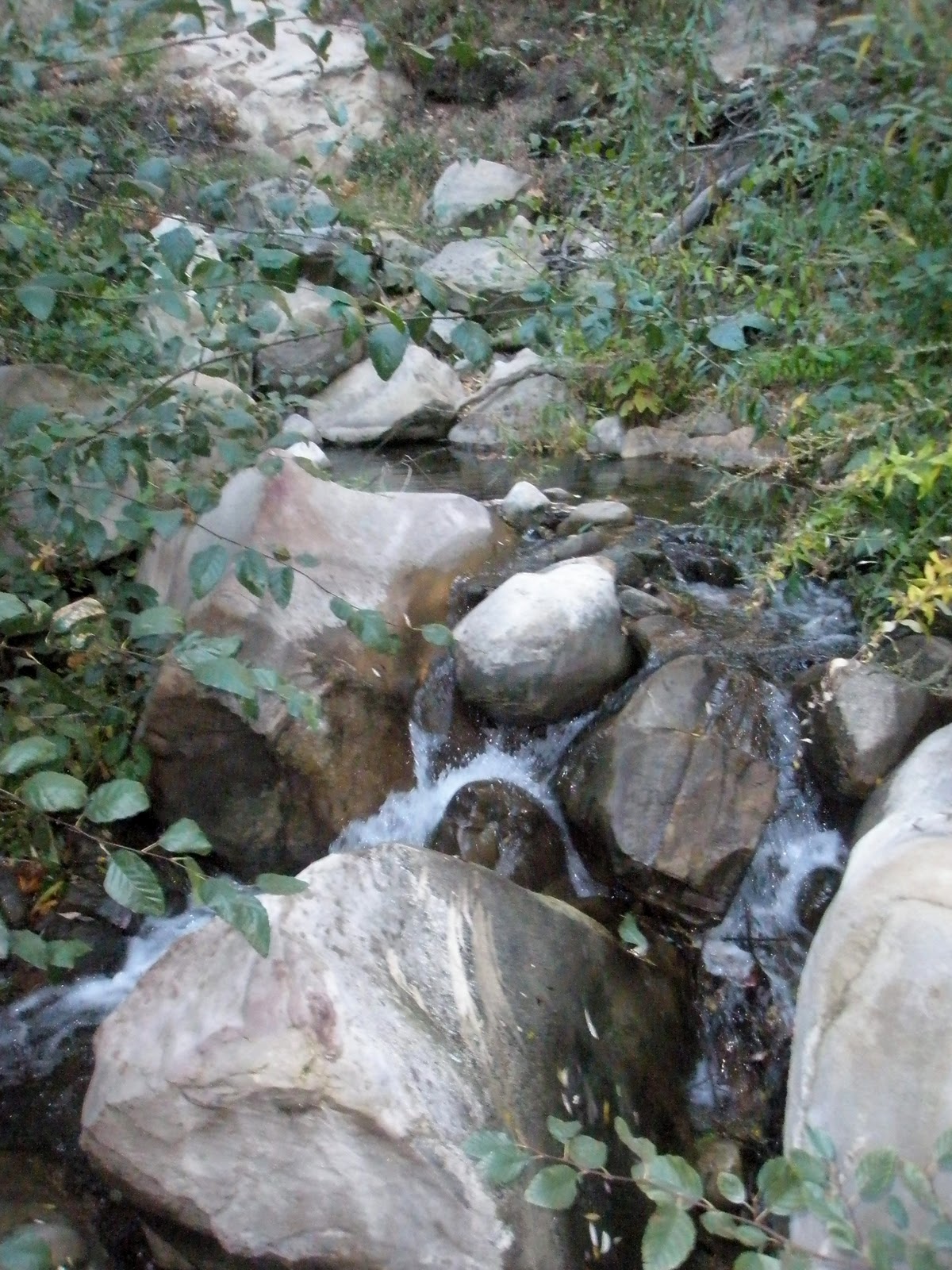
The hike to the cascades was easy enough. I think we only crossed the creek twice. The overhang waterfall was flowing with decent force.
We had to take the sorta sketchy side route on the river-right side due to the high water. There's a bit of exposure, and some careful foot placement is needed, but it wasn't too bad.
It looks like I'm fucking this rock.
After a little down-climbing, and crawling we made it to the 70ft (68ft) falls. Someone had left some black webbing tied to a boulder above the falls. I had to leap across the creek to cut and remove it. Here's a video of Frank pushing some logs over the falls.
Carefully we made our way down to the final section. The big falls were going off magnificently. The waterfall coming off of Bear Heaven was flowing. It only flows after it rains, but that is the tallest waterfall in the Ventura Los Padres that I know of.
Bear Heaven Falls
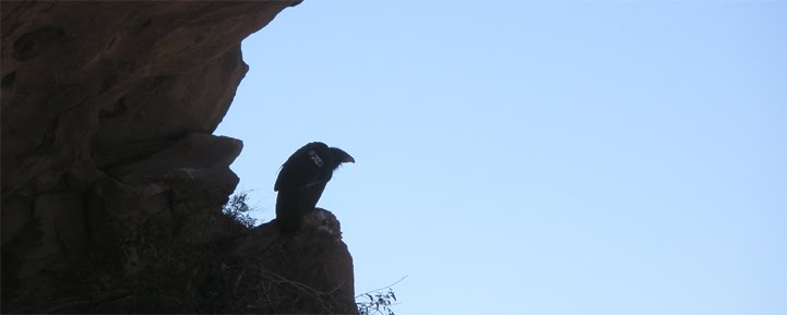
Just as I expected, there was some webbing threaded into the bolts at the big falls. I cut it out. I'll say it again, webbing and rope can kill condors. Please, if you're going to rappel Tar Creek, remove your webbing when you're done. Both rappels have walk arounds that someone in your party can use to bring the webbing down.
The Condors Perch
Then we took some pictures, and ate lunch. The water temperature was 47F. We didn't see any condors. I think this was our fifth trip down Tar Creek this year, and I haven't seen a condor once. In 2009 I saw condors every time we went down there. Sometimes we would see five at a time. I wonder what happened? I've seen them over the Stone Corral the two times we went by this year.
The hike back up was uneventful. It was little muddy, but not bad at all. We bumped into Jack from Jack Elliott's Santa Barbara Adventure on the way up the hill. Maybe he'll have a post about Tar Creek soon too. And that was it. Another trip to Tar Creek in the books. I'm sure there will be many more trips just like this one.
When it rains like it has been for the past few weeks, I really get an itching to get outside, and put some miles under my feet. The creeks are flowing again, snow caps the peaks of some of our taller mountains, and waterfalls are restored to their rightful glory. I love Tar Creek right after a rain. The canyon thunders with the sound of raging, muddy water. In the spring when the water calms down you can hop scotch along the rocks, and try to keep your socks dry. However, when the creek is rocking like it was this day, creek crossings take a more serious tone. If you slip and get caught in the hydraulics you are going to be in a world of hurt. Tar Creek is renowned for its huge purple sandstone boulders. The nice thing about sandstone is it doesn't get too slippery when wet. So jumping on to wet sandstone is not nearly as dangerous as the slick granite you'll encounter further north.
The hike to the cascades was easy enough. I think we only crossed the creek twice. The overhang waterfall was flowing with decent force.
We had to take the sorta sketchy side route on the river-right side due to the high water. There's a bit of exposure, and some careful foot placement is needed, but it wasn't too bad.
It looks like I'm fucking this rock.
After a little down-climbing, and crawling we made it to the 70ft (68ft) falls. Someone had left some black webbing tied to a boulder above the falls. I had to leap across the creek to cut and remove it. Here's a video of Frank pushing some logs over the falls.
Carefully we made our way down to the final section. The big falls were going off magnificently. The waterfall coming off of Bear Heaven was flowing. It only flows after it rains, but that is the tallest waterfall in the Ventura Los Padres that I know of.
Bear Heaven Falls
Just as I expected, there was some webbing threaded into the bolts at the big falls. I cut it out. I'll say it again, webbing and rope can kill condors. Please, if you're going to rappel Tar Creek, remove your webbing when you're done. Both rappels have walk arounds that someone in your party can use to bring the webbing down.
The Condors Perch
Then we took some pictures, and ate lunch. The water temperature was 47F. We didn't see any condors. I think this was our fifth trip down Tar Creek this year, and I haven't seen a condor once. In 2009 I saw condors every time we went down there. Sometimes we would see five at a time. I wonder what happened? I've seen them over the Stone Corral the two times we went by this year.
The hike back up was uneventful. It was little muddy, but not bad at all. We bumped into Jack from Jack Elliott's Santa Barbara Adventure on the way up the hill. Maybe he'll have a post about Tar Creek soon too. And that was it. Another trip to Tar Creek in the books. I'm sure there will be many more trips just like this one.
Labels:
Bear Heaven,
California Condor,
canyoneering,
Rappelling,
Tar Creek
Tuesday, November 30, 2010
11-27-2010 Piedra Blanca Creek
The Piedra Blanca rock formation
I went up to Piedra Blanca a few months ago to do some rappelling, and scouting around. While I was up there I started down the creek, but didn't go very far. Since then I have been wanting to go back, and finish this little loop.
This weekend I felt like needed to burn off some of the pumpkin pie I ate, so I headed back up to the majestic rock formations of Piedra Blanca. The Sespe was flowing nicely at the first crossing. I walked on the trail through the rock formation, and down the hill behind it. There's a big boulder at the bottom of the hill where a seasonal creek flows through. It's there that I left the main trail, and started down towards Piedra Blanca Creek. Once I linked up with the creek I started making my way down south. My goal was to follow the creek back to the Sespe. It didn't take me to long to get the part I call the Piedra Blanca Narrows. This is where the creek cuts through the big rock formation. I was nice and cool down there. There were iced over puddles in the shade near the rocks. The narrows is a nice little section. The rocks are very craggy. There are a few nice chest deep pools for swimming or fishing. At it's narrowest point it got pretty choked with little saplings (Alder?) to the point where I had to rock hop through the middle of the creek.
Just south of the Narrows. The Sespe is a little further south.
After I had made it through the Narrows the landscape opened up into a small valley. I followed a light trail southward for a bit. I was making such good time that I decided to climb up one of the hills on the west side of the creek to get a better perspective. From up there I could see the Sespe wasn't to far away. I made my way back down, and continued south. The trail petered out, and I had to bulldoze through some of the thickest brush I've ever encountered. I was a pain in the butt. But, eventually it cleared up, and I found myself on a little trail that ran by the Thacher Cabin. I was respectful of their property, and left it alone (they have a nice set up).
Thacher Cabin
And that was it. I was back on the Sespe trail. A few minutes later, and I was back in the parking lot. I talked to a nice fellow who had spent a few nights up near Willett Hot Spring. I saw few people headed out towards Willett as well. I hope they made it there okay, because it started raining about four hours later.
That's it. I just got a new camera, so my future posts should have better quality pictures. Take care.
I went up to Piedra Blanca a few months ago to do some rappelling, and scouting around. While I was up there I started down the creek, but didn't go very far. Since then I have been wanting to go back, and finish this little loop.
This weekend I felt like needed to burn off some of the pumpkin pie I ate, so I headed back up to the majestic rock formations of Piedra Blanca. The Sespe was flowing nicely at the first crossing. I walked on the trail through the rock formation, and down the hill behind it. There's a big boulder at the bottom of the hill where a seasonal creek flows through. It's there that I left the main trail, and started down towards Piedra Blanca Creek. Once I linked up with the creek I started making my way down south. My goal was to follow the creek back to the Sespe. It didn't take me to long to get the part I call the Piedra Blanca Narrows. This is where the creek cuts through the big rock formation. I was nice and cool down there. There were iced over puddles in the shade near the rocks. The narrows is a nice little section. The rocks are very craggy. There are a few nice chest deep pools for swimming or fishing. At it's narrowest point it got pretty choked with little saplings (Alder?) to the point where I had to rock hop through the middle of the creek.
Just south of the Narrows. The Sespe is a little further south.
After I had made it through the Narrows the landscape opened up into a small valley. I followed a light trail southward for a bit. I was making such good time that I decided to climb up one of the hills on the west side of the creek to get a better perspective. From up there I could see the Sespe wasn't to far away. I made my way back down, and continued south. The trail petered out, and I had to bulldoze through some of the thickest brush I've ever encountered. I was a pain in the butt. But, eventually it cleared up, and I found myself on a little trail that ran by the Thacher Cabin. I was respectful of their property, and left it alone (they have a nice set up).
Thacher Cabin
And that was it. I was back on the Sespe trail. A few minutes later, and I was back in the parking lot. I talked to a nice fellow who had spent a few nights up near Willett Hot Spring. I saw few people headed out towards Willett as well. I hope they made it there okay, because it started raining about four hours later.
That's it. I just got a new camera, so my future posts should have better quality pictures. Take care.
Labels:
Piedra Blanca,
Sespe,
Willett Hot Spring
Monday, November 15, 2010
11-12-2010 Agua Blanca Creek
Cobblestone Mountain Foothils
One of the more impressive geological features of the Southern Los Padres rivers are the narrows. It happens when a river that normally meanders through rolling hills cuts through a rock formation, creating a narrow slot. Some examples I know would be the Sespe Narrows below Devils Heart Peak, and again further south at Devil's Gate. There's also The Alder Creek Narrows, and Piedra Blanca Creek has a narrows section. Agua Blanca Creek has two narrows sections, The Devil's Gateway, and The Big Narrows.
Dave Stillman contacted me recently to see if I was interested in checking out The Big Narrows. I knew it would a tough, probably nasty hike. So I signed up, and recruited Frank to come too.
We decided to make it a three day trip. Friday morning we hiked from Dough Flat to Ant Camp. Ant Camp sits at the base of Cobblestone Mountain where Agua Blanca Creek turns east towards Piru. It only took about three hours to make the trek. The trail is great condition. Someone, maybe the CCC, has recently trimmed, and flagged the trail going down the big hill that leads to Ant Camp. I tip my hat to whomever did that hard work, thanks. Once down at Ant Camp we set up our stuff, collected water, and gathered wood in anticipation of some cold nights.
Ant Camp
We also set up the horseshoe stakes to standard distance. Now you can enjoy a nice game of horseshoes next time you go down there. It was a pretty brisk evening, but the fire was large, and kept us warm until we ready for bed.
Trying to stay warm
The next morning we woke up a prepared for the difficult challenge we were expecting. We started heading east along side the creek at about 8:20. The trail isn't too bad for the first mile or so. We saw a few spots that would make fairly descent campsites in a pinch. There used to be a campsite called Tin Can Cabin down here. We made a good effort to find some sort of trace of it, but I'm afraid that all signs of it are completely gone now.
Looking for Tin Can Cabin
The trail got steadily worse the further we went. The poison oak was ubiquitous as expected. There were also those nasty, thorny vines everywhere too. Tons of fallen trees blocked the way. Sometimes the only way through was to slog through the creek.
After about three hours from the start the canyon started to zig-zag, and really narrow, aggressively. Finally we got to a point where you could no longer skirt the edge of the creek, we were entering The Big Narrows.
An ominous looking rock formation
Entering The Big Narrows
The walls squeezed to about ten to twenty feet wide, and rose 500 to 600 feet high. Frank and I removed our boots, and put on the water shoes we had brought with us. The water was 49.5 Fahrenheit. I wore heavy wool socks with my shoes, but my feet were still freezing. Frank had better luck with neoprene. The creek turned north then sharply came around a corner and headed south. We stopped in that section and had lunch.
If we had decided to continue I think we would have made it to Cove Camp in maybe another hour, who knows? But, we decided that we had gone far enough. We had been hiking for about four hours. I figured that since we had been going down stream it would probably take us longer to get back to camp. But I was wrong. We bulldozed back to camp in only three hours. We gathered a little bit more wood for the evening. Then we focused on dinner. We traded some stories around the fire, and then headed to bed.
The next morning we gathered up our stuff, cleaned up the camp a bit. The last people there had left behind some trash like tin foil, bottle wrappers, and batteries. The hike up the hill wasn't to bad. I found some more batteries on the way up. What's up with that? It's like someone was going up the hill, found it to difficult, and decided to ditch four AAA batteries to shed weight, pathetic. Anyway, it was an easy hike out. There were some locals shooting up the parking lot when we got back. Not much you can do except leave. You can check out some shaky videos from the trip here, here, and here.
So if you like being cold, dirty, hungry, tired, stinky, sore, getting bug bites, itchy rashes, lacerated arms and legs, wet feet, filthy hands, and chapped lips then this is a hike you may enjoy.
If you have ever done this hike, or made it all the way to Piru, I would love to hear about it. Feel free to leave a comment, or send me an email. Take care.
One of the more impressive geological features of the Southern Los Padres rivers are the narrows. It happens when a river that normally meanders through rolling hills cuts through a rock formation, creating a narrow slot. Some examples I know would be the Sespe Narrows below Devils Heart Peak, and again further south at Devil's Gate. There's also The Alder Creek Narrows, and Piedra Blanca Creek has a narrows section. Agua Blanca Creek has two narrows sections, The Devil's Gateway, and The Big Narrows.
Dave Stillman contacted me recently to see if I was interested in checking out The Big Narrows. I knew it would a tough, probably nasty hike. So I signed up, and recruited Frank to come too.
We decided to make it a three day trip. Friday morning we hiked from Dough Flat to Ant Camp. Ant Camp sits at the base of Cobblestone Mountain where Agua Blanca Creek turns east towards Piru. It only took about three hours to make the trek. The trail is great condition. Someone, maybe the CCC, has recently trimmed, and flagged the trail going down the big hill that leads to Ant Camp. I tip my hat to whomever did that hard work, thanks. Once down at Ant Camp we set up our stuff, collected water, and gathered wood in anticipation of some cold nights.
Ant Camp
We also set up the horseshoe stakes to standard distance. Now you can enjoy a nice game of horseshoes next time you go down there. It was a pretty brisk evening, but the fire was large, and kept us warm until we ready for bed.
Trying to stay warm
The next morning we woke up a prepared for the difficult challenge we were expecting. We started heading east along side the creek at about 8:20. The trail isn't too bad for the first mile or so. We saw a few spots that would make fairly descent campsites in a pinch. There used to be a campsite called Tin Can Cabin down here. We made a good effort to find some sort of trace of it, but I'm afraid that all signs of it are completely gone now.
Looking for Tin Can Cabin
The trail got steadily worse the further we went. The poison oak was ubiquitous as expected. There were also those nasty, thorny vines everywhere too. Tons of fallen trees blocked the way. Sometimes the only way through was to slog through the creek.
After about three hours from the start the canyon started to zig-zag, and really narrow, aggressively. Finally we got to a point where you could no longer skirt the edge of the creek, we were entering The Big Narrows.
An ominous looking rock formation
Entering The Big Narrows
The walls squeezed to about ten to twenty feet wide, and rose 500 to 600 feet high. Frank and I removed our boots, and put on the water shoes we had brought with us. The water was 49.5 Fahrenheit. I wore heavy wool socks with my shoes, but my feet were still freezing. Frank had better luck with neoprene. The creek turned north then sharply came around a corner and headed south. We stopped in that section and had lunch.
If we had decided to continue I think we would have made it to Cove Camp in maybe another hour, who knows? But, we decided that we had gone far enough. We had been hiking for about four hours. I figured that since we had been going down stream it would probably take us longer to get back to camp. But I was wrong. We bulldozed back to camp in only three hours. We gathered a little bit more wood for the evening. Then we focused on dinner. We traded some stories around the fire, and then headed to bed.
The next morning we gathered up our stuff, cleaned up the camp a bit. The last people there had left behind some trash like tin foil, bottle wrappers, and batteries. The hike up the hill wasn't to bad. I found some more batteries on the way up. What's up with that? It's like someone was going up the hill, found it to difficult, and decided to ditch four AAA batteries to shed weight, pathetic. Anyway, it was an easy hike out. There were some locals shooting up the parking lot when we got back. Not much you can do except leave. You can check out some shaky videos from the trip here, here, and here.
So if you like being cold, dirty, hungry, tired, stinky, sore, getting bug bites, itchy rashes, lacerated arms and legs, wet feet, filthy hands, and chapped lips then this is a hike you may enjoy.
If you have ever done this hike, or made it all the way to Piru, I would love to hear about it. Feel free to leave a comment, or send me an email. Take care.
Labels:
Agua Blanca,
Ant Camp,
Cove Camp,
Dough Flat,
Hollister Camp,
The Big Narrows,
Tin Can Cabin
10-24-2010 Cozy Dell Trail
Megan wanted to go on a short hike, and get some fresh air. I thought the popular Cozy Dell Trail might be just hike to do. It's a short pleasant hike with a few nice views of Ojai. It was bit overcast his day, but still worth the effort. We cleaned up some trash. There were a few other people out on the trail too. You know you're on an easy trail when you see a five year old girl in a princess outfit walking out. It was a nice way to get out of the house, and knock some rust loose.
Subscribe to:
Posts (Atom)